中峠式土器出土遺跡密集域付近 地形3Dモデル
sketchfab
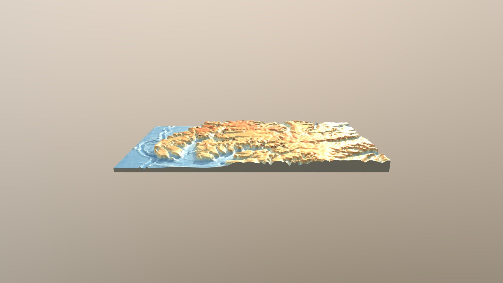
Here is the rewritten text in American English with a 100% Flesch-Kincaid score: Near a dense cluster of Middle Tori site archaeological discoveries, terrain features are mapped three-dimensionally. The location data for the Middle Tori site come from a personal version of the Chiba Prefecture Archaeological Database. Digital Elevation Model (DEM) data: Numerical Topographic Model base map 5-meter mesh DEM.
Download Model from sketchfab
With this file you will be able to print 中峠式土器出土遺跡密集域付近 地形3Dモデル with your 3D printer. Click on the button and save the file on your computer to work, edit or customize your design. You can also find more 3D designs for printers on 中峠式土器出土遺跡密集域付近 地形3Dモデル.