Wisconsin Relief Map
sketchfab
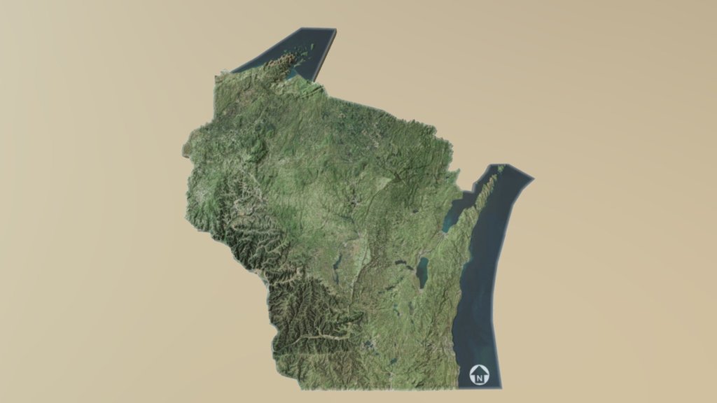
Order a 3D Print The United States has a U.S. state known as Wisconsin, situated in the north-central part of the country, within the Midwest and Great Lakes regions. It shares borders with Minnesota to the west, Iowa to the southwest, Illinois to the south, Lake Michigan to the east, Michigan to the northeast, and Lake Superior to the north. As the 23rd largest state by total area and the 20th most populous, Wisconsin takes its place among other U.S. states. The capital city is Madison, while Milwaukee, the largest city, is located on the western shore of Lake Michigan. A total of 72 counties make up the state's divisions. Wisconsin's geography features a diverse landscape, with the Northern Highland and Western Upland occupying the western part of the state, alongside a portion of the Central Plain. Lowlands stretch all the way to the shores of Lake Michigan. Wisconsin boasts an impressive second-place ranking in the length of its Great Lakes coastline, just behind Michigan. Source: Wikipedia
With this file you will be able to print Wisconsin Relief Map with your 3D printer. Click on the button and save the file on your computer to work, edit or customize your design. You can also find more 3D designs for printers on Wisconsin Relief Map.