Whitsunbank 2 (Jan 2007)
sketchfab
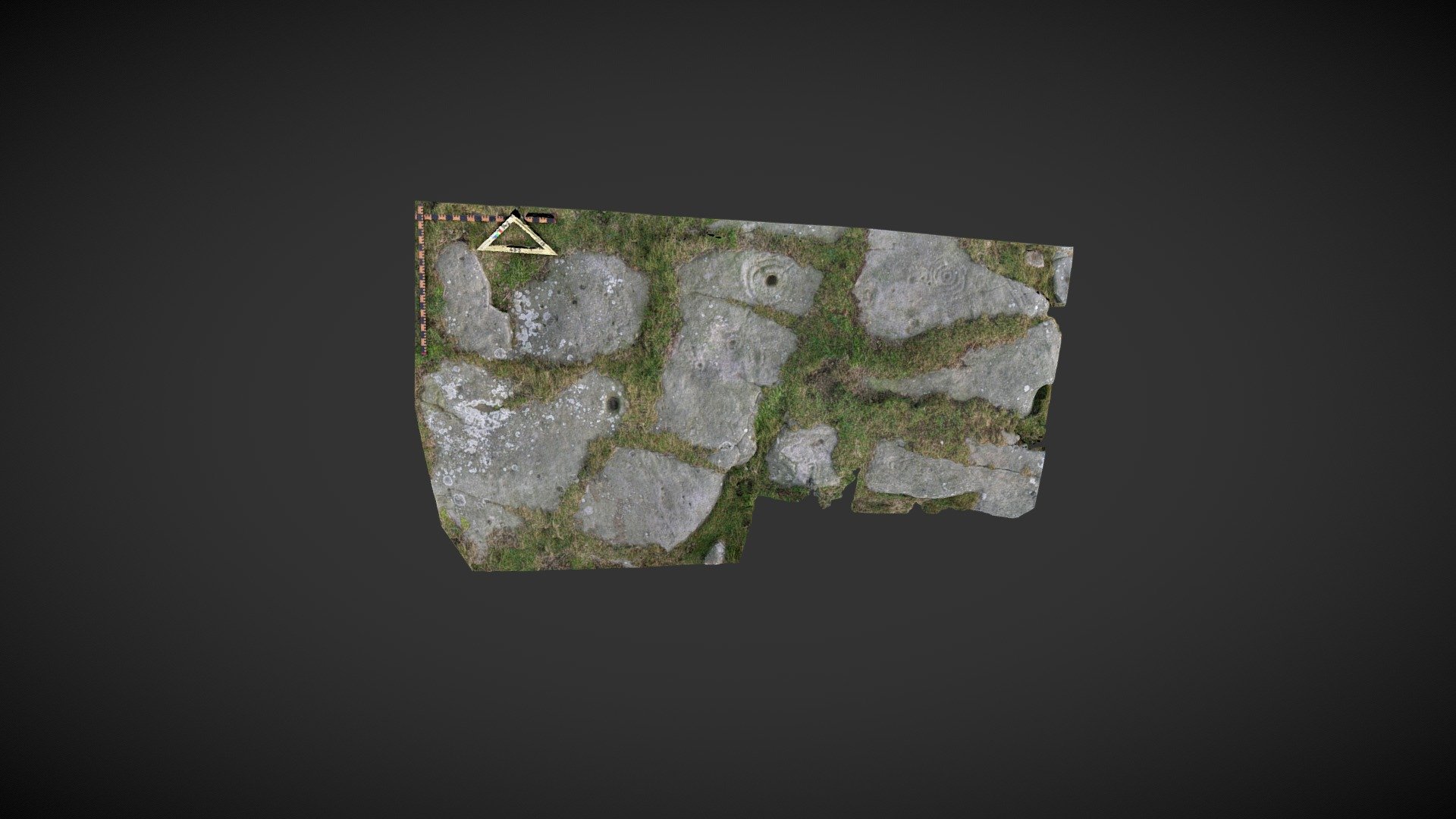
Area of exposed outcrop situated on Whitsunbank Hill, a section of Weetwood Moor near Wooler in Northumberland. This exposure is divided into separate parts by narrow fissures filled with turf. Most exposures feature motifs carved onto them, including cups, cup and ring patterns, and cups with multiple rings and radial grooves. Several depressions may be naturally occurring. Originally listed as 'Whitsunbank 2' in the Beckensall Archive (BA), it was later added to ERA as 'Whitsunbank 2a' by NADRAP in 2008. ERA record including BA material: https://archaeologydataservice.ac.uk/era/section/panel/overview.jsf?eraId=165 Historic England area scheduling: https://historicengland.org.uk/listing/the-list/list-entry/1418763 Model created in September 2019 from stereo pairs captured by Joe Gibson during NADRAP recording in January 2007. A calibrated Nikon Coolpix 5400 with a 5mp camera was used to capture the imagery, which is part of the NADRAP / ERA archive. Some areas of the model contain data noise due to insufficient coverage for SfM applications.
With this file you will be able to print Whitsunbank 2 (Jan 2007) with your 3D printer. Click on the button and save the file on your computer to work, edit or customize your design. You can also find more 3D designs for printers on Whitsunbank 2 (Jan 2007).