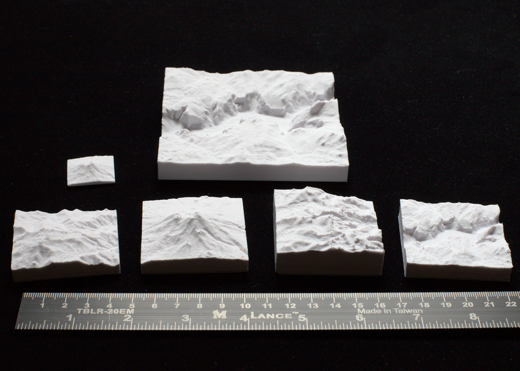
Whitney, Shasta, San Jacinto, Yosemite 3D Maps
thingiverse
TinyMtn Free Pack 3 - California This is a package with 3D model files for four notable landscapes in the state of California, USA. Mt. Whitney 14,505 ft / 4421 m Mt. San Jacinto 10,843 ft / 3305 m Mt. Shasta 14,168 ft / 4319 m Yosemite (Mt. Starr King) 9096 ft / 2772 m Each represents a square patch of ground 12.5km on a side, and measures 50mm at 1:250000 scale. At that size, each model can print in about an hour, but if you want faster printing or larger models, use the following guide: Factor Size Scale Time 50% 1"/25mm 1:500000 20 min 100% 2"/50mm 1:250000 1-2 hrs 200% 4"/100mm 1:125000 4-6 hrs 400% 8"/200mm 1:62500 8-15 hrs In addition, there are two versions of each model: a standard version with a short and consistent base, and a (usually) taller version which represents the entire feature from sea level to summit. Print the former if you want to compare the mountains by height above their base, print the sea level versions if you want to compare mountains by their absolute elevation. There is text embossed 0.6mm deep on the bottom of each model. This fits ideally whether you want to print these models at 0.1, 0.15, 0.2, or 0.3mm layer thicknesses. We recommend adaptive layer thickness between 0.15 and 0.3mm as a compromise between quality and speed. When printing larger models, consider adding "ears" to each corner to prevent pull-up. Do this in Prusaslicer with right click->Add Shape->Cylinder, then scale it to about 10mm diameter and 0.4mm thick, and copy one to each corner. You can easily snip these off the final print. If you found these files useful and want to see more, please drop $1 in the donation link, click on like, and/or post a make. Thank you! Mark Founder, TinyMtn and MiniCity TinyMtn has been designing and printing 3D mountains for over a decade. We have over 1000 different models on Shapeways - many in full color - and build custom artworks large and small for all sorts of purposes. In addition, our sister site MiniCity.Art produces massively-detailed and carefully assembled 3D models of cities. Each of over 60 cities can be ordered in multiple sizes, with the largest artworks covering 10 square feet or more. Visit our massive catalog of 3D landscapes and cityscapes at the following sites: http://tinymtn.com http://tinymtn.etsy.com http://minicity.art http://minicityart.etsy.com https://society6.com/summerstreet (C) 2023 TinyMtn (TM) Models created using GDAL, NetPBM, Gmsh, Carve, MeshLab, and other custom software Source of digital elevation data: U.S. Geological Survey The USGS home page is http://www.usgs.gov/
With this file you will be able to print Whitney, Shasta, San Jacinto, Yosemite 3D Maps with your 3D printer. Click on the button and save the file on your computer to work, edit or customize your design. You can also find more 3D designs for printers on Whitney, Shasta, San Jacinto, Yosemite 3D Maps.
