West Horton 1e (May 2006)
sketchfab
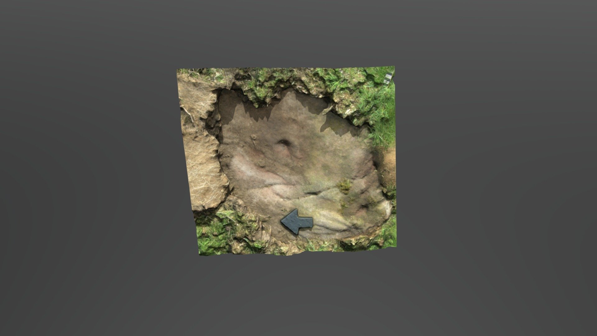
Small patch of exposed rock lies hidden within a private farm near West Horton in Northumberland. This cluster of carvings, one of several, was pinpointed by the NADRAP team as 'West Horton 1e' on the Beckensall Archive (BA). The NADRAP team documented: 'Cup and linear groove under turf are faint but likely genuine. The exposed cup is clearly defined with possible arc.' There's uncertainty whether this area matches the original BA record, yet there's little doubt these markings were intentionally created. ERA & BA info: https://archaeologydataservice.ac.uk/era/section/panel/overview.jsf?eraId=69 Historic England scheduling: https://historicengland.org.uk/listing/the-list/list-entry/1006532 This model is generated from 4 random images captured by NADRAP Team 1 in May 2006. The imagery forms part of the complete NADRAP archive stored with Historic England and Northumberland County Council.
With this file you will be able to print West Horton 1e (May 2006) with your 3D printer. Click on the button and save the file on your computer to work, edit or customize your design. You can also find more 3D designs for printers on West Horton 1e (May 2006).