West Branch Deerfield River
sketchfab
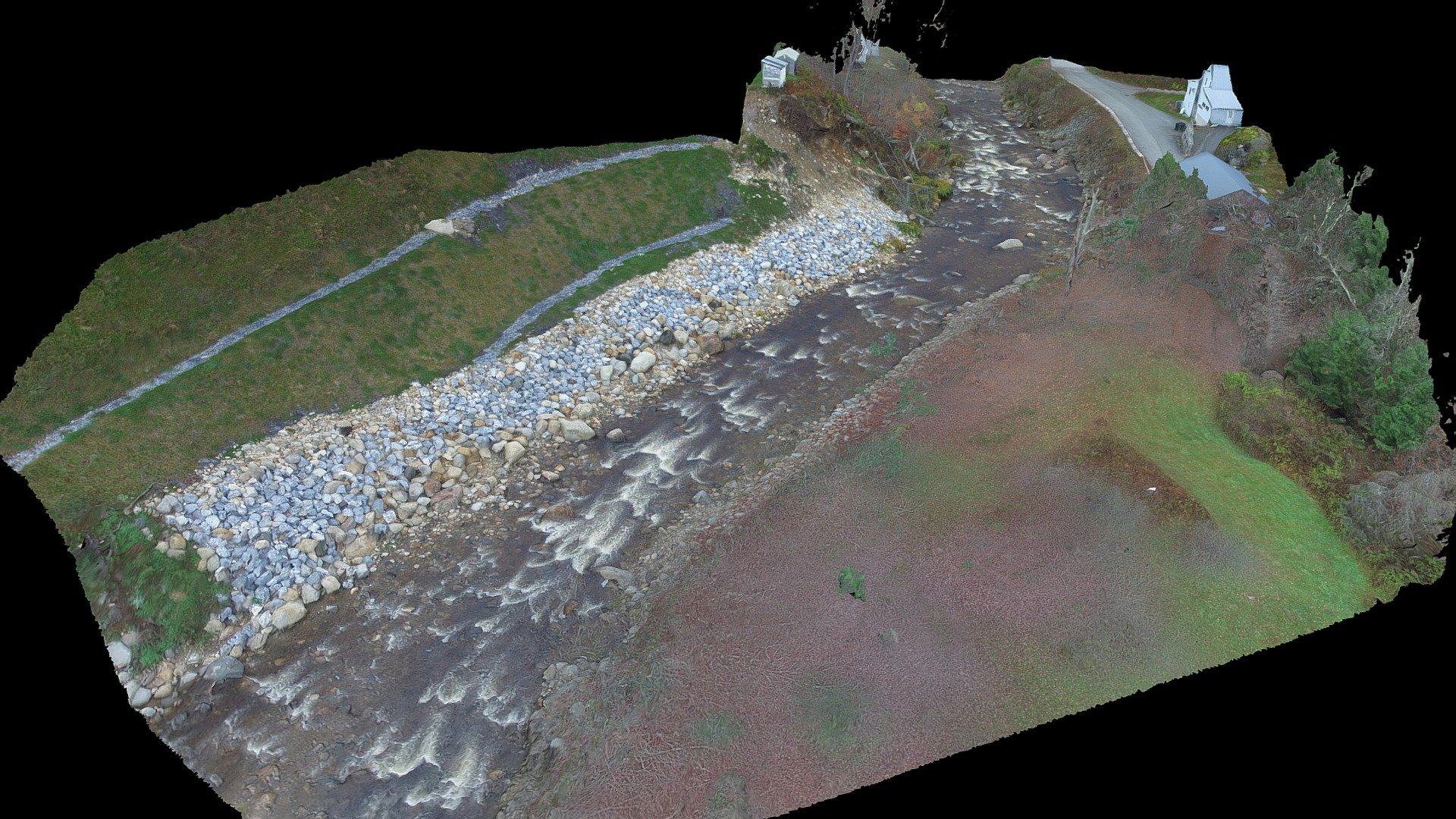
Part of the West Branch Deerfield River flows through Readsboro, Vermont. Aerial imagery was captured using a DJI Phantom 3 Pro drone flying at exactly 100 feet above ground level. The resulting 525 overlapping still images and slightly angled 4K video were processed in Agisoft PhotoScan Professional. This project began on November 1, 2017. We would like to extend our gratitude to Dr. Kevin Gardner for providing expert advice on this work at the University of New Hampshire. We also appreciate the assistance of Scott Greenwood and Keelin Berger in conducting fieldwork and processing imagery. This model was developed with resources from a National Science Foundation EPSCoR-funded project called “RII Track-2 FEC: Strengthening Decision-Making about Dams through Multi-scale, Coupled Systems Research on Ecological, Social, and Economic Trade-offs”. The National Science Foundation supported this project under NSF grant #IIA-1539071. Any opinions or conclusions expressed here are those of the authors and may not reflect the views of the National Science Foundation.
With this file you will be able to print West Branch Deerfield River with your 3D printer. Click on the button and save the file on your computer to work, edit or customize your design. You can also find more 3D designs for printers on West Branch Deerfield River.