UAV-based integrated outcrop Siilinjaervi
sketchfab
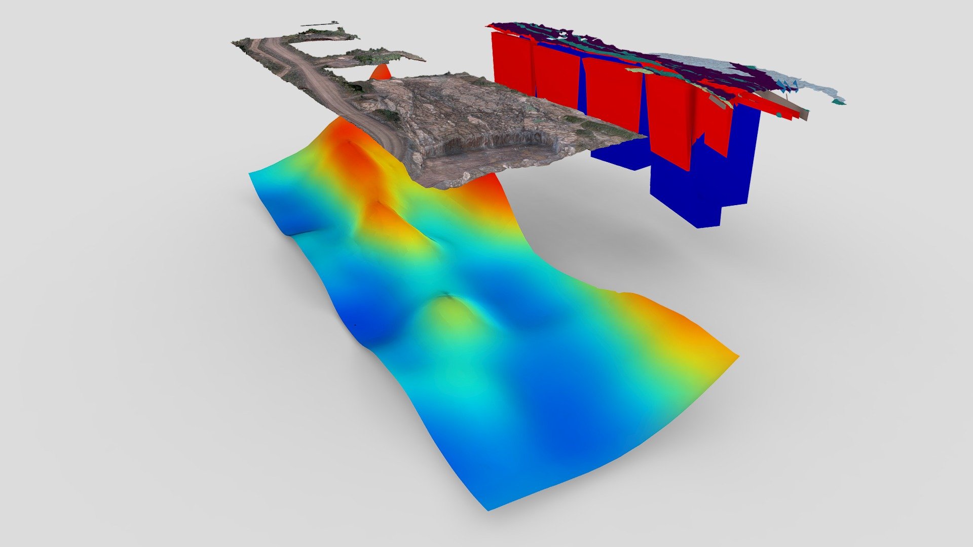
Jaakonlampi test area, Siilinjärvi phosphat mine: The left model shows a detailed RGB mesh and accurately interpolated total magnetic data. The right model displays integrated data layers of image classification, structural planes, and precisely modelled tabular subsurface bodies. Reference: Jackisch, R.; Lorenz, S.; Kirsch, M.; Zimmermann, R.; Tusa, L.; Pirttijärvi, M.; Saartenoja, A.; Ugalde, H.; Madriz, Y.; Savolainen, M.; Gloaguen, R. Integrated Geological and Geophysical Mapping of a Carbonatite-Hosting Outcrop in Siilinjärvi, Finland, Using Unmanned Aerial Systems. Remote Sensing 2020, 12, 2998. Open access link: https://www.mdpi.com/2072-4292/12/18/2998 Helmholtz-Zentrum Dresden-Rossendorf, Helmholtz Institute Freiberg for Resource Technology Department of Exploration Visit https://www.hzdr.de/db/Cms?pNid=3055&pOid=38648 for further information. Magnetic UAS data acquired by Radai Oy, visit https://radai.fi/ for further details.
With this file you will be able to print UAV-based integrated outcrop Siilinjaervi with your 3D printer. Click on the button and save the file on your computer to work, edit or customize your design. You can also find more 3D designs for printers on UAV-based integrated outcrop Siilinjaervi.