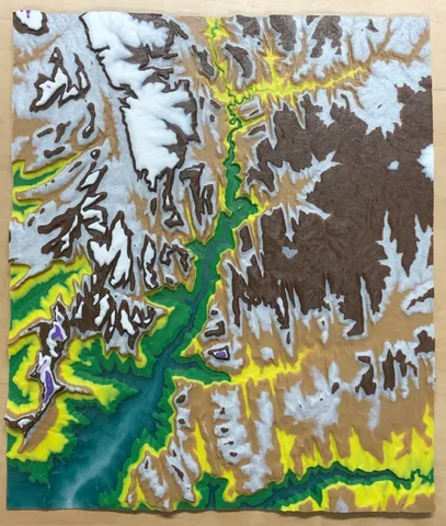
Topographic Map of Zion National Park
prusaprinters
Topographic map of the main valley at Zion National Park in Utah. Covers the main valley and the East Entrance. Pulled data using TouchTerrain and sliced in PrusaSlicer to add color changes.Colors shown (base to mountain tops):Marble (to back the translucent)Translucent dark greenGreenYellowTanMarbleBrownWhitePurple Close up photo is Angels Landing.
Download Model from prusaprinters
With this file you will be able to print Topographic Map of Zion National Park with your 3D printer. Click on the button and save the file on your computer to work, edit or customize your design. You can also find more 3D designs for printers on Topographic Map of Zion National Park.
