The Rigg 15 (April 2008)
sketchfab
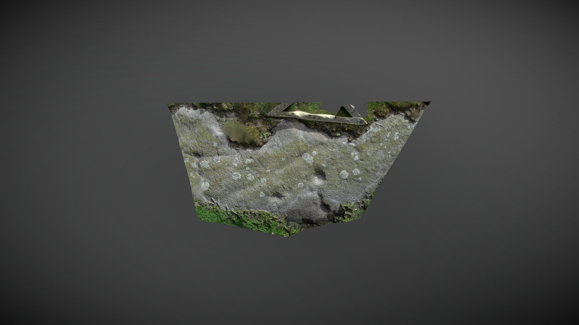
Area of outcrop discovered WSW of The Rigg, SW of Lartington, County Durham. This section of exposed outcrop is situated on private pasture, a few hundred metres directly west of the other known panels. It was first identified during NADRAP surveys and referenced ‘Lartington, The Rigg 15’ on ERA in 2008. The NADRAP team describes this panel as marking the western extremity of carved outcrop at Lartington Rigg, with ERA ref 940 marking the eastern extent of marked outcrop approximately 790 meters away. Three eroded cups are visible, two linked by a groove that appears to extend beyond the second cup to the edge of the panel. The known panels of Lartington, The Rigg, all appear in an east-west strip along the same strata, leaving no doubt that more remains to be discovered. ERA record: https://archaeologydataservice.ac.uk/era/section/panel/overview.jsf?eraId=944 Model created from five images captured by NADRAP Team 5 in April 2008, which form part of the full NADRAP archive deposited with Historic England.
With this file you will be able to print The Rigg 15 (April 2008) with your 3D printer. Click on the button and save the file on your computer to work, edit or customize your design. You can also find more 3D designs for printers on The Rigg 15 (April 2008).