The archaeological site "Pla de les tenalles"
sketchfab
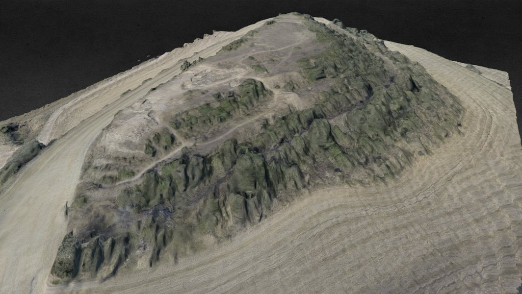
Ancient Iberian archaeological site, dating back to the 5th century BC. Aerial photogrammetry experiment using a Phantom2 drone and GoPro4 camera. Processed from 93 images, resulting in 617,000 face reconstructions and 8,000 texture maps. Georeferenced at N 41.651913°, E 1.203048°. Viewable on Google Maps at https://goo.gl/maps/K2CasQGPVkD2
Download Model from sketchfab
With this file you will be able to print The archaeological site "Pla de les tenalles" with your 3D printer. Click on the button and save the file on your computer to work, edit or customize your design. You can also find more 3D designs for printers on The archaeological site "Pla de les tenalles".