Test 3D Map
sketchfab
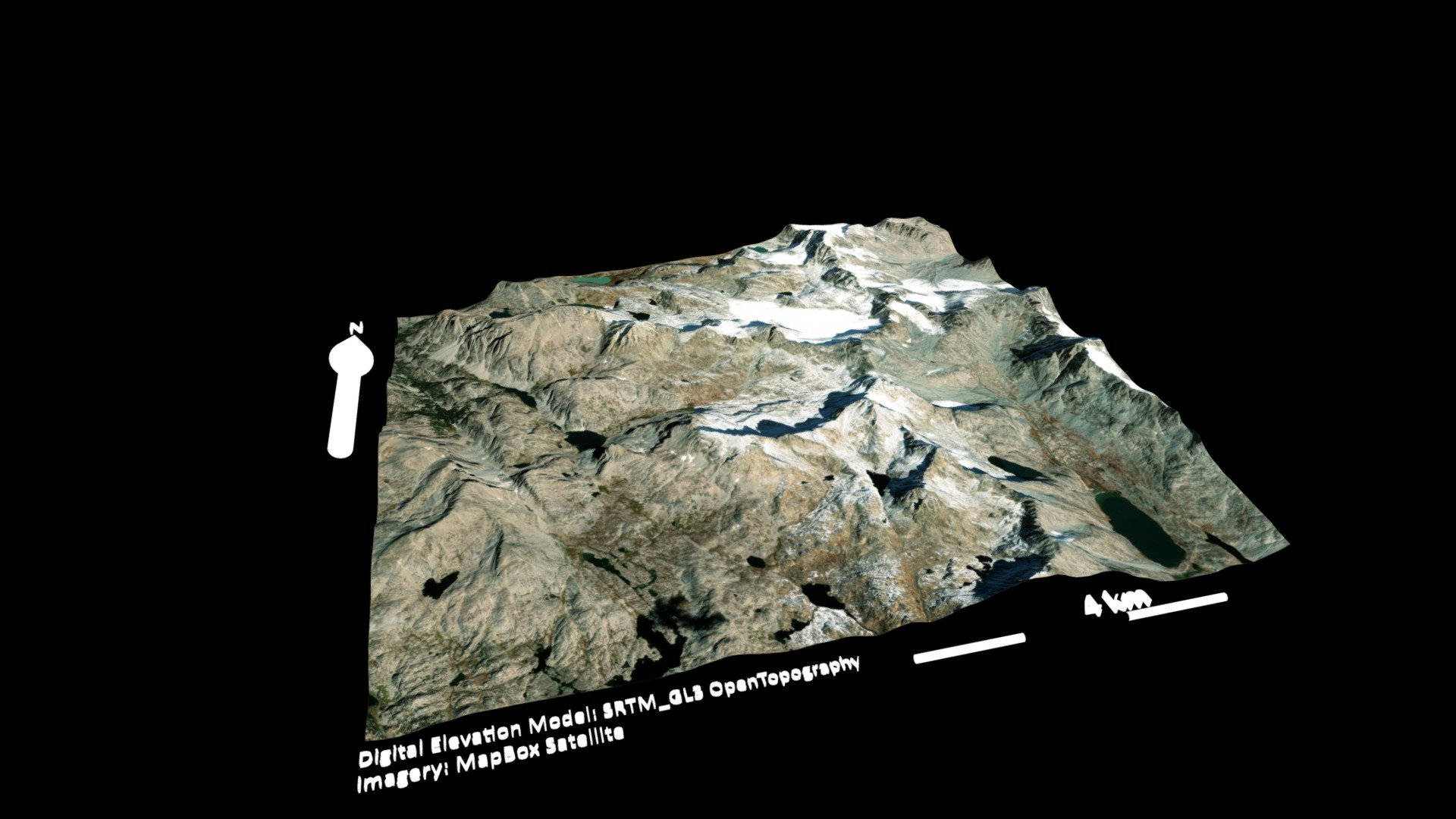
The course requirements are being tested using the GEOS 315 curriculum. The Generator is leveraging the DEM (Digital Elevation Model) data from the SRTM_GL3 OpenTopography API to create a three-dimensional model of the terrain. This model is then being used in conjunction with high-resolution satellite imagery from MapBox Satellite to generate a comprehensive view of the landscape.
Download Model from sketchfab
With this file you will be able to print Test 3D Map with your 3D printer. Click on the button and save the file on your computer to work, edit or customize your design. You can also find more 3D designs for printers on Test 3D Map.