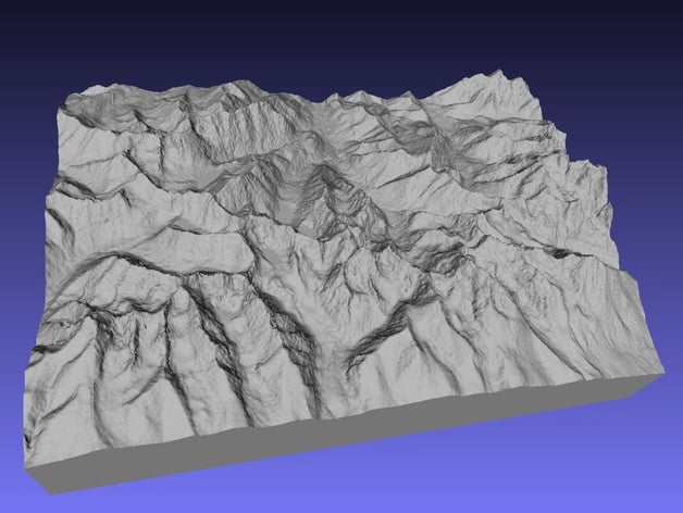
Tatra Mountains - Slovakia/Poland
thingiverse
Constructed from high-resolution data provided by the Space Shuttle at an impressive 1 arcsecond, resulting in a detailed mesh consisting of approximately 1.36 million polygons. Utilizing an unreleased beta version of SRTM2STL software, which is open to public scrutiny under the GNU license, it was developed on top of robust source code that enables the creation of 3 arcsecond resolution files. To access this cutting-edge tool, simply visit github and conduct a search for SRTM2STL. **Instructions** You may need to print out these maps at a relatively small scale to avoid issues with warping, especially when using PLA. Printing Raised Relief Maps at larger sizes can further exacerbate this problem. However, if you're able to fine-tune your printer's settings and successfully control warping, you may find improved results even when working with bigger maps.
With this file you will be able to print Tatra Mountains - Slovakia/Poland with your 3D printer. Click on the button and save the file on your computer to work, edit or customize your design. You can also find more 3D designs for printers on Tatra Mountains - Slovakia/Poland.