Stobgreen Plantation N01 (Aug 2005)
sketchfab
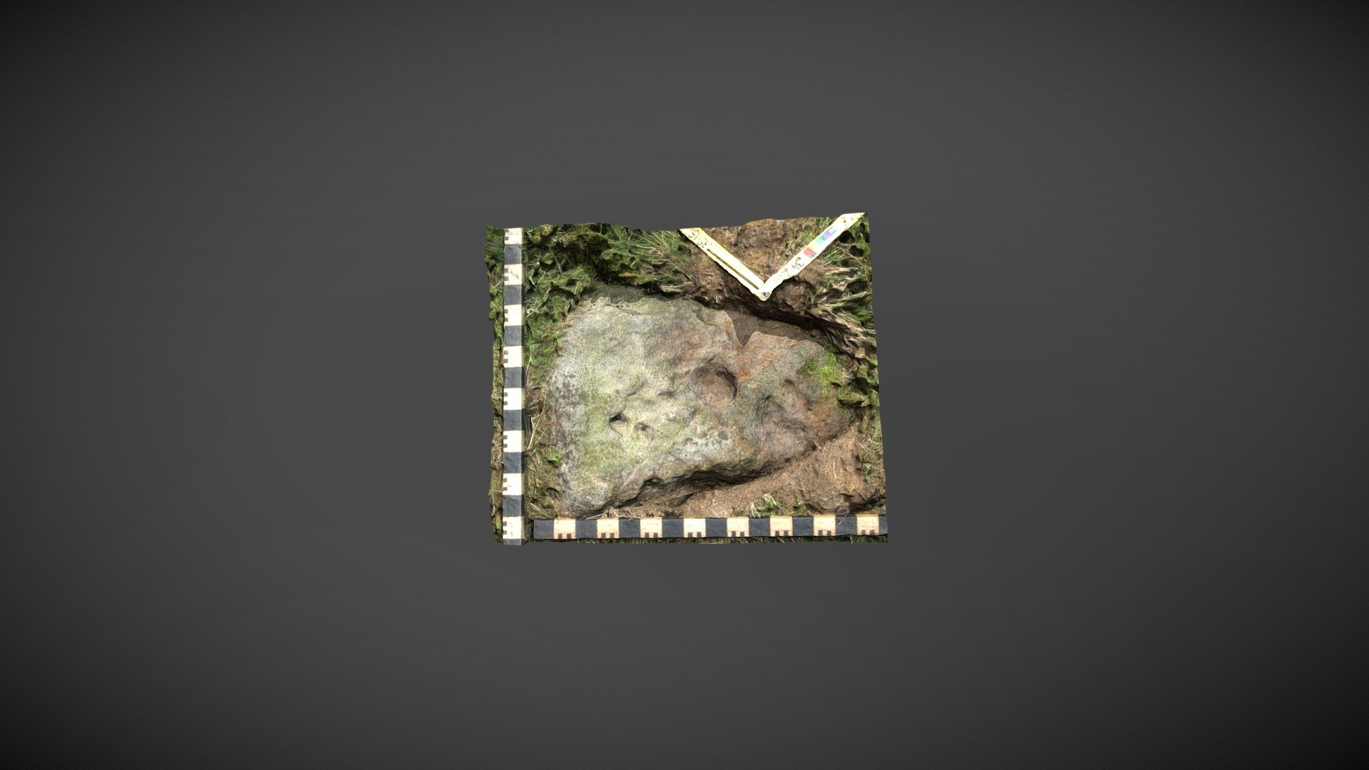
Probable prehistoric carved boulder discovered on private land within Stobgreen Plantation, north of Eggleston, County Durham. Possibly listed as 'D10312' in the county's Historic Environment Record. NADRAP added this record to ERA referencing 'Stobgreen Plantation N01' and describing: 'Two cups and one possible cup, carved into the flat surface of a boulder, are shallow and large in diameter compared to the panel measuring 0.09 - 0.10 meters in diameter and 0.02 meters deep. Noteworthy is this triangular, pointed rock with large cups carved into its pointed end. The stone is very quartz-rich and has voids where crystals have dropped out. The cups are almost certainly artificial and similar in size, though not depth, to Brackenheads 3 which is approximately 500 meters away.' ERA information: https://archaeologydataservice.ac.uk/era/section/panel/overview.jsf?eraId=2013 A model was created from five stereo pairs captured by Joe Gibson (NADRAP Team 3) in August 2005. This imagery forms part of the full NADRAP archive deposited with Historic England.
With this file you will be able to print Stobgreen Plantation N01 (Aug 2005) with your 3D printer. Click on the button and save the file on your computer to work, edit or customize your design. You can also find more 3D designs for printers on Stobgreen Plantation N01 (Aug 2005).