Stobgreen Plantation 3 (Aug 2005)
sketchfab
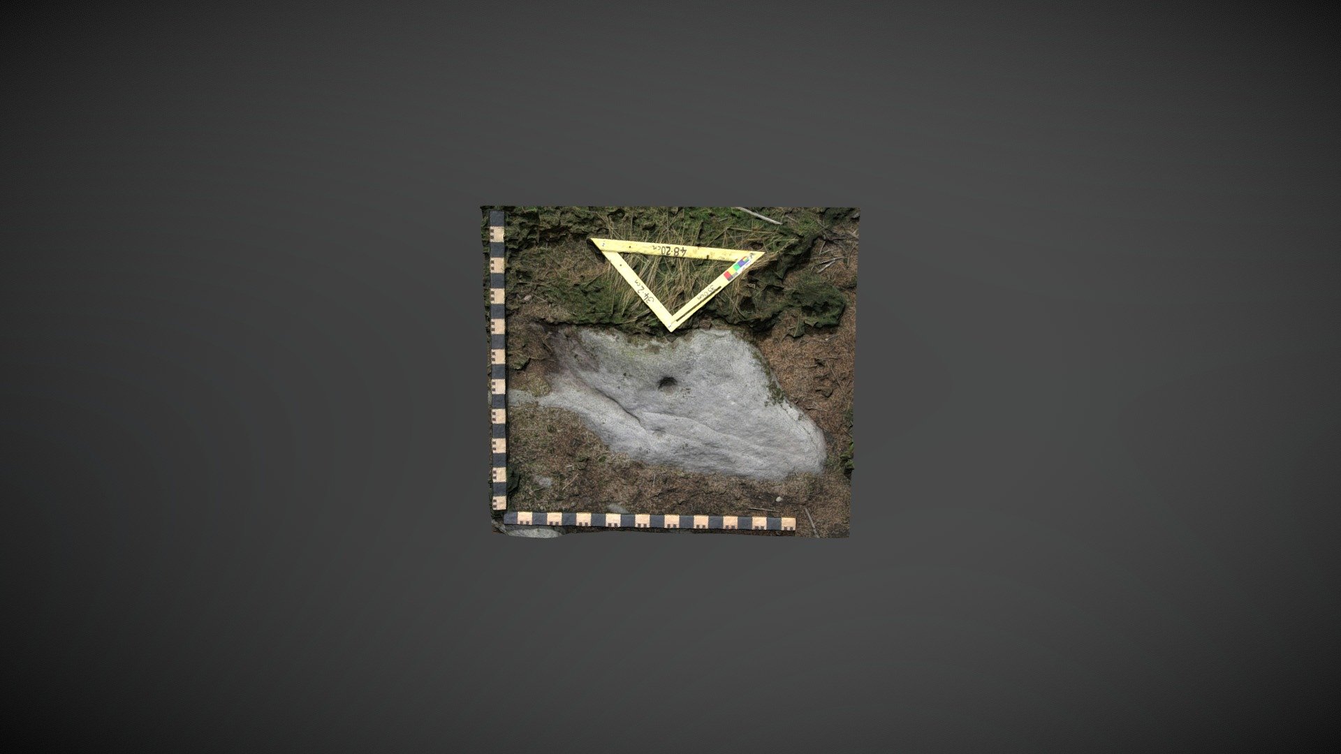
Scheduled prehistoric carved boulder discovered on private land within Stobgreen Plantation, north of Eggleston, County Durham. First documented by Paul Brown in 1996, this rock was referred to as 'Stobgreen Plantation 3' by NADRAP on ERA and described as: A flat and very white panel with small markings on a relatively large open canvas. The panel lies flat on the ground, covered by turf and soil. Parallel grooves are likely bedding planes or cracks that have been unusually enhanced. Two cups are clearly visible; possibly a third. The grid reference on ERA is incorrect (off by 300 meters). Historic England record NZ00935 23554. ERA information: https://archaeologydataservice.ac.uk/era/section/panel/overview.jsf?eraId=2020 Historic England scheduling: https://historicengland.org.uk/listing/the-list/list-entry/1021115 The model was created from five stereo pairs captured by Joe Gibson (NADRAP Team 3) in August 2005. The imagery forms part of the full NADRAP archive deposited with Historic England.
With this file you will be able to print Stobgreen Plantation 3 (Aug 2005) with your 3D printer. Click on the button and save the file on your computer to work, edit or customize your design. You can also find more 3D designs for printers on Stobgreen Plantation 3 (Aug 2005).