Stobgreen Plantation 1 (Aug 2005)
sketchfab
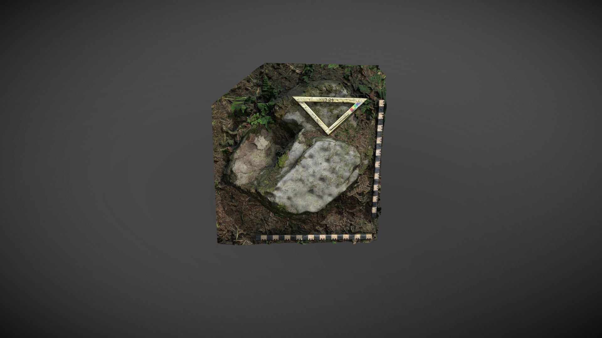
Scheduled prehistoric carved boulder discovered on private property within Stobgreen Plantation, north of Eggleston, County Durham. First documented by Paul Brown in 1996, this rock was referenced 'Stobgreen Plantation 1' by the NADRAP team on ERA and described as: Panel features two distinct layers. The upper layer is marked extensively with numerous small cup-shaped depressions, measuring between 0.05 to 0.07 meters in diameter and shallow. No patterns are visible, but most of the upper surface has been covered. Other features may have been removed by quarrying, creating multiple levels and a strong straight edge on the panel. ERA information is available online at https://archaeologydataservice.ac.uk/era/section/panel/overview.jsf?eraId=2011. The boulder was scheduled by Historic England as part of their list entry 1021115. A 3D model was created from five stereo pairs captured by Joe Gibson, a member of the NADRAP Team 3, in August 2005. This imagery is part of the full NADRAP archive deposited with Historic England.
With this file you will be able to print Stobgreen Plantation 1 (Aug 2005) with your 3D printer. Click on the button and save the file on your computer to work, edit or customize your design. You can also find more 3D designs for printers on Stobgreen Plantation 1 (Aug 2005).