Slovakia
thingiverse
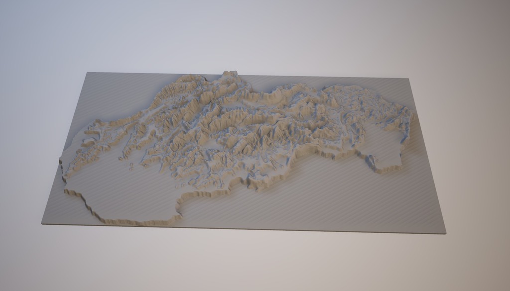
Slovak Republic Geographic Map The Slovak Republic is a landlocked country situated in Central Europe, bordered by Austria to the west, the Czech Republic to the northwest, Poland to the north, Ukraine to the east, and Hungary to the south. Its geography can be divided into three main regions: the Lowlands, the Mountains, and the Eastern Slope. The Lowlands cover nearly 45% of the country's area, with the Vistula River flowing through it from west to east. The region is relatively flat and consists mainly of fertile alluvial plains. The capital city, Bratislava, is located here. The Mountains occupy about 40% of Slovak territory, stretching across its western half. This rugged terrain includes several mountain ranges, such as the Tatra Mountains, the Fatra-Turzovka Mountains, and the Low Tatras. These mountains offer stunning scenery, numerous hiking trails, and opportunities for skiing, climbing, and other winter sports. The Eastern Slope region accounts for roughly 15% of the country's area. This area borders Ukraine to the east and is characterized by low hills, forests, and fertile valleys. The landscape here is more rolling than mountainous, with many small rivers flowing through it. The climate varies across different regions within the Slovak Republic, but generally ranges from temperate continental to oceanic. Summer temperatures are mild, while winters can be quite cold. Precipitation levels vary, with the western mountains receiving more rainfall than the eastern lowlands.
With this file you will be able to print Slovakia with your 3D printer. Click on the button and save the file on your computer to work, edit or customize your design. You can also find more 3D designs for printers on Slovakia.