Royal Basin - Royal Lake Topo map
thingiverse
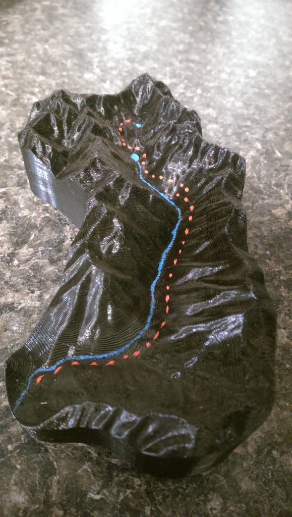
This is a high-resolution topographic map of the Royal Basin - Royal Lake trail that I've had the pleasure of hiking myself. It's one of my standout hikes to date, and I'm excited to share it with you. Please note that this file contains an abundance of detailed information, allowing you to zoom in as much as you like without compromising on clarity.
Download Model from thingiverse
With this file you will be able to print Royal Basin - Royal Lake Topo map with your 3D printer. Click on the button and save the file on your computer to work, edit or customize your design. You can also find more 3D designs for printers on Royal Basin - Royal Lake Topo map.