Relief Maps of Bora Bora
thingiverse
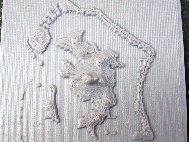
The relief map of Bora Bora is available at thing:106099, featuring Hawaiian terrain. The data originates from Aster Global Dem, accessible via Earth Explorer (http://earthexplorer.usgs.gov/). This non-commercial dataset requires registration and agreement not to redistribute or alter the data without crediting "Aster GDEM by METI and NASA." Aster GDEM files are geotiff format global elevation data sets, with a 1 arc-second resolution file downloaded for conversion. Guides on using this data can be found at http://www.jspacesystems.or.jp/ersdac/GDEM/ver2Validation/GDEM_QuickGuide2.pdf and http://www.jspacesystems.or.jp/ersdac/GDEM/E/1.html. Two stl files are provided, Bora_bora_archipelago.stl (85x90mm) and Bora_bora_central_island.stl (59x94mm), printed directly on the build platform. The height in these models is 1mm per 133 meters, with a highest point of 7.5mm or 600 meters above sea level.
With this file you will be able to print Relief Maps of Bora Bora with your 3D printer. Click on the button and save the file on your computer to work, edit or customize your design. You can also find more 3D designs for printers on Relief Maps of Bora Bora.