Print Your Run !!!
thingiverse
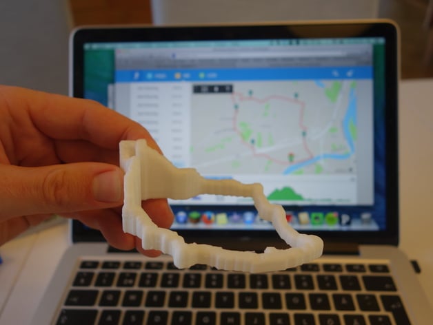
Introducing a unique program that transforms your GPS data into 3D-printable STL files! Simply download Processing and relevant libraries, then input your GPX data file to visualize your run on screen. Press 's' to export the model as an STL, which will be saved alongside your input file for easy printing. Don't forget to include your GPS device's GPX file and place it in the same folder as the application, named 'input.gpx'. This program offers two visualizations - a floating path and an elevation-stretched view originating from a base level. Remember to print with support if you choose the floating track option. While currently tested only on Northern Hemisphere GPX files, this versatile tool caters to personal needs and welcomes contributions for further enhancements.
With this file you will be able to print Print Your Run !!! with your 3D printer. Click on the button and save the file on your computer to work, edit or customize your design. You can also find more 3D designs for printers on Print Your Run !!!.