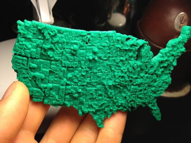
Pocket Unemployment Map of the United States
pinshape
I Decided to Create an Unemployment Map Using My 3D Printer for My Computational Economics Class. I Took a US County Unemployment Map from 2009 and Turned It into a 3D Object, Displaying Unemployment Levels by Relative Height. It Also Functions as a Precise Pocket Map of the US. Instructions: Print with 40% Infill Using PLA or ABS. The STL Scales Well, So Feel Free to Print in Any Dimensions. Calibrate Your E-Retraction Length Carefully, or You'll Get Strands. It Would Be Awesome If Someone Else Printed This Before I Submit My Paper on Friday - I'd Totally Mention It! The Javascript Used Can Be Found at Thingiverse: http://www.thingiverse.com/thing:15276. The Economic Data Came from the Bureau of Labor Statistics, and the Image is Available Here: http://flowingdata.com/wp-content/uploads/2012/01/Unemployment-choropleth-425x278.png
With this file you will be able to print Pocket Unemployment Map of the United States with your 3D printer. Click on the button and save the file on your computer to work, edit or customize your design. You can also find more 3D designs for printers on Pocket Unemployment Map of the United States.
