Penycrocbren Early Lead Mining Landscape
sketchfab
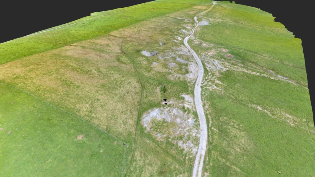
A seemingly flat landscape that holds secrets beneath its surface invites closer inspection. Zooming in on the annotated areas reveals more. The Penycrocbren ridge is traversed by Glyndwr's Way, a trail following an ancient road believed to have Roman roots. This road measures 26.5m x 23.5m and features a single turf rampart standing 0.8m high with a single gateway on the north side that spans 3m wide. Excavations in 1960 uncovered the interior, which was covered by a floor of chippings, substantial gate posts at the entrance, and pottery dating back to the mid-to-late 2nd century AD. The placename Pen-y-crocbren translates to Gallows Top, and a gibbet mound lies just west of the Roman fort, built upon an older prehistoric burial site. In 1938, archaeologists discovered remains of gibbeting irons with a skull inside near this location, which are now on display at St. Fagans National History Museum. Former lead mining shafts follow a sub-surface vein, and remnants of a hushing reservoir and channel can be seen, radiocarbon-dated to 980-1170 AD.
With this file you will be able to print Penycrocbren Early Lead Mining Landscape with your 3D printer. Click on the button and save the file on your computer to work, edit or customize your design. You can also find more 3D designs for printers on Penycrocbren Early Lead Mining Landscape.