Palo Duro Canyon Topography Texas State Park
thingiverse
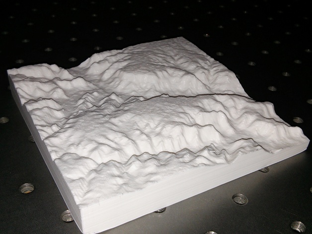
This is an illustration of Palo Duro Canyon State Park's geography. The canyon spans far, yet this graphic shows only its section that falls within the state park boundaries. At nearly one-third the length of Arizona's Grand Canyon, it ranks as the second largest in the US. Instructions Manufactured with PLA filament on an Ultimaker 2 printer utilizing CURA's default "normal" settings. There are several minor pin-sized imperfections along the model's upper edge due to insufficient extrusion caused by a blockage in my hotend assembly, likely from under-extrusion during the printing process. To expedite print times and achieve higher yields per session, I intentionally bedded this print 5mm below optimal specifications. The resultant prints proved to have acceptable structural integrity despite initial misgivings. Using web tools at jthatch.com you may also produce similar files in STL format as per my own model above. Additionally, following initial download I fine-tuned this model by running a few simple commands with the no-cost software package NetFAB Repair tool on default mode, resulting in cleanups and smoothing the rough spots.
With this file you will be able to print Palo Duro Canyon Topography Texas State Park with your 3D printer. Click on the button and save the file on your computer to work, edit or customize your design. You can also find more 3D designs for printers on Palo Duro Canyon Topography Texas State Park.