Oyster River Reservoir Dam (Lower Altitude)
sketchfab
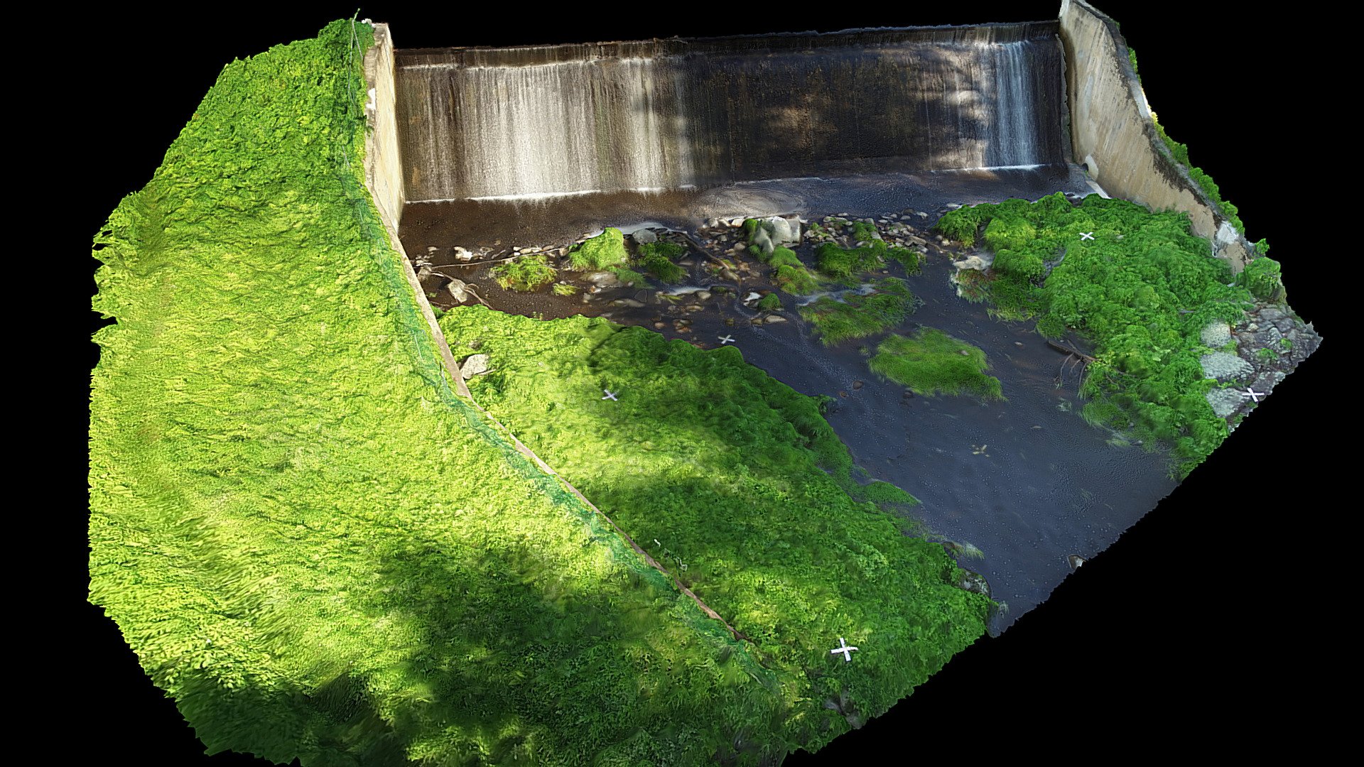
Oyster River Reservoir Dam basks in partial shade on a sunny day in Durham, NH. Situated off Waterworks Rd., 370 stills from nadir and angled 4K video footage captured by a DJI P3P drone were meticulously processed in Agisoft PhotoScan Professional. At an altitude of 35 ft AGL, the drone collected imagery on June 28, 2017. Dr. Kevin Gardner is credited with advising this endeavor at the University of New Hampshire. Scott Greenwood and Keelin Berger received special thanks for their assistance with fieldwork and processing. This model was crafted using resources from the NSF EPSCoR funded project "RII Track-2 FEC: Strengthening scientific decision-making about dams through multi-scale, coupled-systems research on ecological, social, and economic trade-offs". The National Science Foundation's Research Infrastructure Improvement NSF #IIA-1539071 provided critical support for this project. Any opinions, findings, or recommendations expressed in this material are the exclusive responsibility of the author(s) and do not necessarily reflect the views of the National Science Foundation.
With this file you will be able to print Oyster River Reservoir Dam (Lower Altitude) with your 3D printer. Click on the button and save the file on your computer to work, edit or customize your design. You can also find more 3D designs for printers on Oyster River Reservoir Dam (Lower Altitude).