North Lordenshaw 6h (Jan 2006)
sketchfab
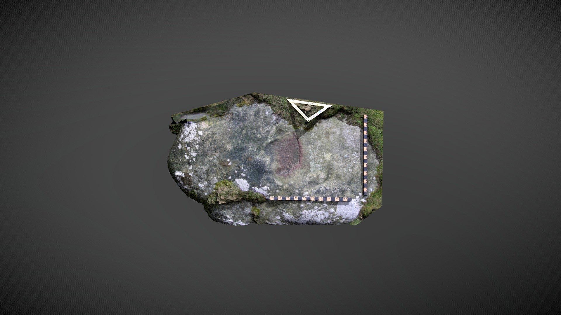
Outcrop on private farmland near Whitton Dean, south of Rothbury, Northumberland, is located. This area of exposed outcrop features several carvings separated by turf and is listed as 'North Lordenshaw 6h' in the Beckensall Archive (BA). NADRAP broke the recording down into three separate panels: 6h(i), 6h(ii), and 6h(iii) and added the records to ERA in 2008. This model showcases carvings on 6h(iii) and is described as follows: A single cup mark, measuring 0.10 m - 0.11m in diameter, was identified close to a band of hard ironstone and several depressions that may be natural. Some midget-finger tip depressions near the quarried edge could be associated with quarrying activity. ERA and BA information can be found at https://archaeologydataservice.ac.uk/era/section/panel/overview.jsf?eraId=1235. The model was created from six stereo pairs captured by Joe Gibson of NADRAP Team 3 in January 2006. The imagery is part of the full NADRAP archive deposited with Historic England and Northumberland County Council.
With this file you will be able to print North Lordenshaw 6h (Jan 2006) with your 3D printer. Click on the button and save the file on your computer to work, edit or customize your design. You can also find more 3D designs for printers on North Lordenshaw 6h (Jan 2006).