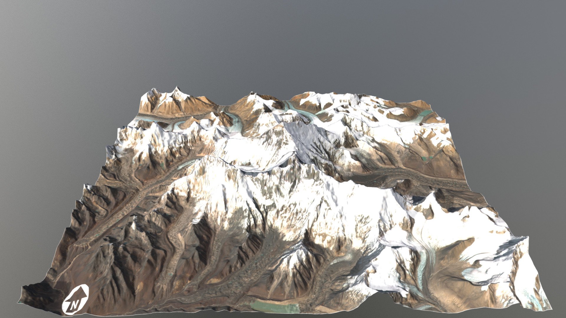
Mount Everest Region - Topographic Surface
sketchfab
Mount Everest, known in Nepali as Sagarmāthā and in Tibetan as Chomolungma, stands proudly as Earth's highest mountain above sea level. Located in the Mahalangur Himal sub-range of the Himalayas, its summit point is marked by an international border between China's Tibet Autonomous Region and Nepal. The current official elevation of 8,848 meters (29,029 feet), recognized by both China and Nepal, was established through a precise Indian survey in 1955. This measurement was later confirmed by a Chinese survey in 1975. However, in 2005, China conducted its own rock height remeasurement of the mountain, resulting in an elevation of 8844.43 meters. Following this discovery, a disagreement arose between China and Nepal regarding which official height should be recognized: the rock height of 8,844 meters claimed by China or the snow height of 8,848 meters supported by Nepal. In 2010, both countries reached an agreement that the official height of Mount Everest is indeed 8,848 meters. Additionally, Nepal acknowledged and accepted China's claim that the mountain's rock height is precisely 8,844 meters.
With this file you will be able to print Mount Everest Region - Topographic Surface with your 3D printer. Click on the button and save the file on your computer to work, edit or customize your design. You can also find more 3D designs for printers on Mount Everest Region - Topographic Surface.