Morwick 2d (May 2008)
sketchfab
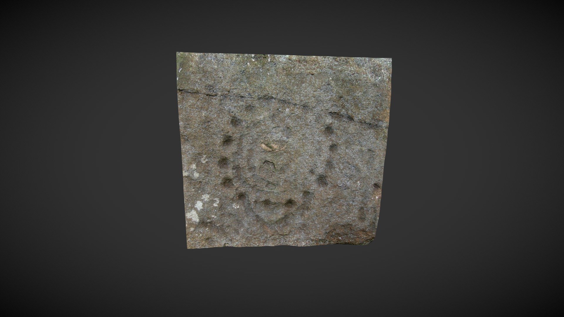
Situated on the south banks of the River Coquet southwest of Warkworth in Northumberland, this cliff is also known as 'Jack Rock', 'Morwick Crag' and 'Morwick Rock Shelter'. It features numerous prehistoric carvings on its face. Several sections of the cliff are recorded with carvings, most of which are at an inaccessible height. Recorded as Morwick 2d in the Beckensall Archive, ERA records state: 'An arc of small cups encloses curved grooves and one or more central rings.' The arc of a curved groove extends below the lower cups. A faint anti-clockwise spiral set within the inner ring described by Beckensall was not recorded. The center of the motif has been recently badly damaged. ERA/BA records can be found at https://archaeologydataservice.ac.uk/era/section/panel/overview.jsf?eraId=614. Historic England scheduling information is available at https://historicengland.org.uk/listing/the-list/list-entry/1014482. A 3D model of the site was created in September 2019 using five images taken by NADRAP Team 2 in May 2008, which formed part of the NADRAP/ERA archive.
With this file you will be able to print Morwick 2d (May 2008) with your 3D printer. Click on the button and save the file on your computer to work, edit or customize your design. You can also find more 3D designs for printers on Morwick 2d (May 2008).