Moel Y Gaer Hillfort; Wales
sketchfab
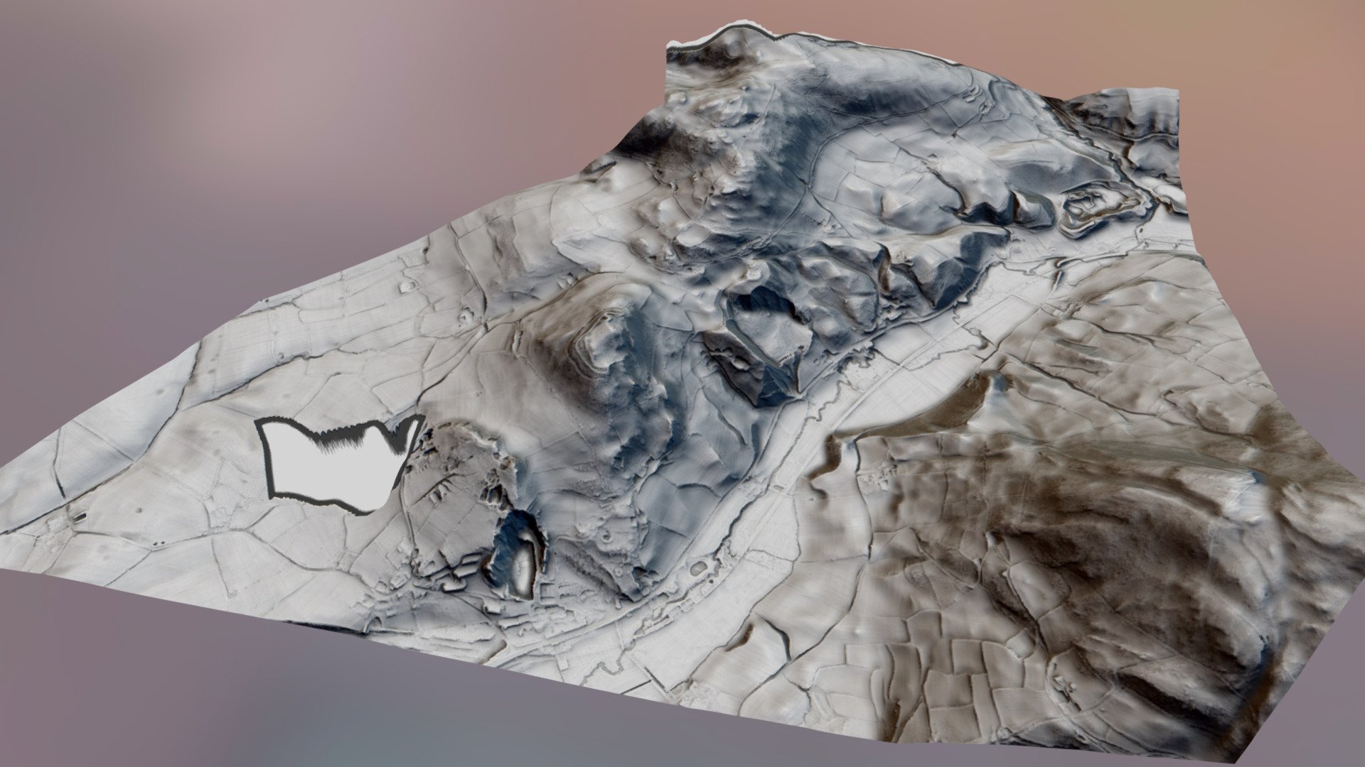
Moel Y Gaer, located in Bodfari, is a Clwydian hillfort situated at approximately 200m above sea level. Positioned outside the village of Bodfari, it lies about 5 miles northeast of Denbigh within the northern Clwydian Range. Strategically placed atop a distinct hill, this site offers an unobstructed view of the confluence of the Rivers Chwiler and Clwyd. The enclosed area measures roughly 2 hectares. A visible enclosure is clearly evident to the north, as seen on some Google satellite images. For further information, visit http://www.walesher1974.org/herumd.php?group=CPAT&level=3&docid=301364142 or http://www.megalithic.co.uk/article.php?sid=5979. The data used to create this model consists of 2-meter DTM LiDAR data obtained from Natural Resources Wales. The Python coding was kindly provided by Mike Gill, a member of the Avon Valley Archaeological Society, and can be found on https://github.com/mike-gill/qgis2sketchfab.
With this file you will be able to print Moel Y Gaer Hillfort; Wales with your 3D printer. Click on the button and save the file on your computer to work, edit or customize your design. You can also find more 3D designs for printers on Moel Y Gaer Hillfort; Wales.