Model of Overthrust of Korotaikha Depression
sketchfab
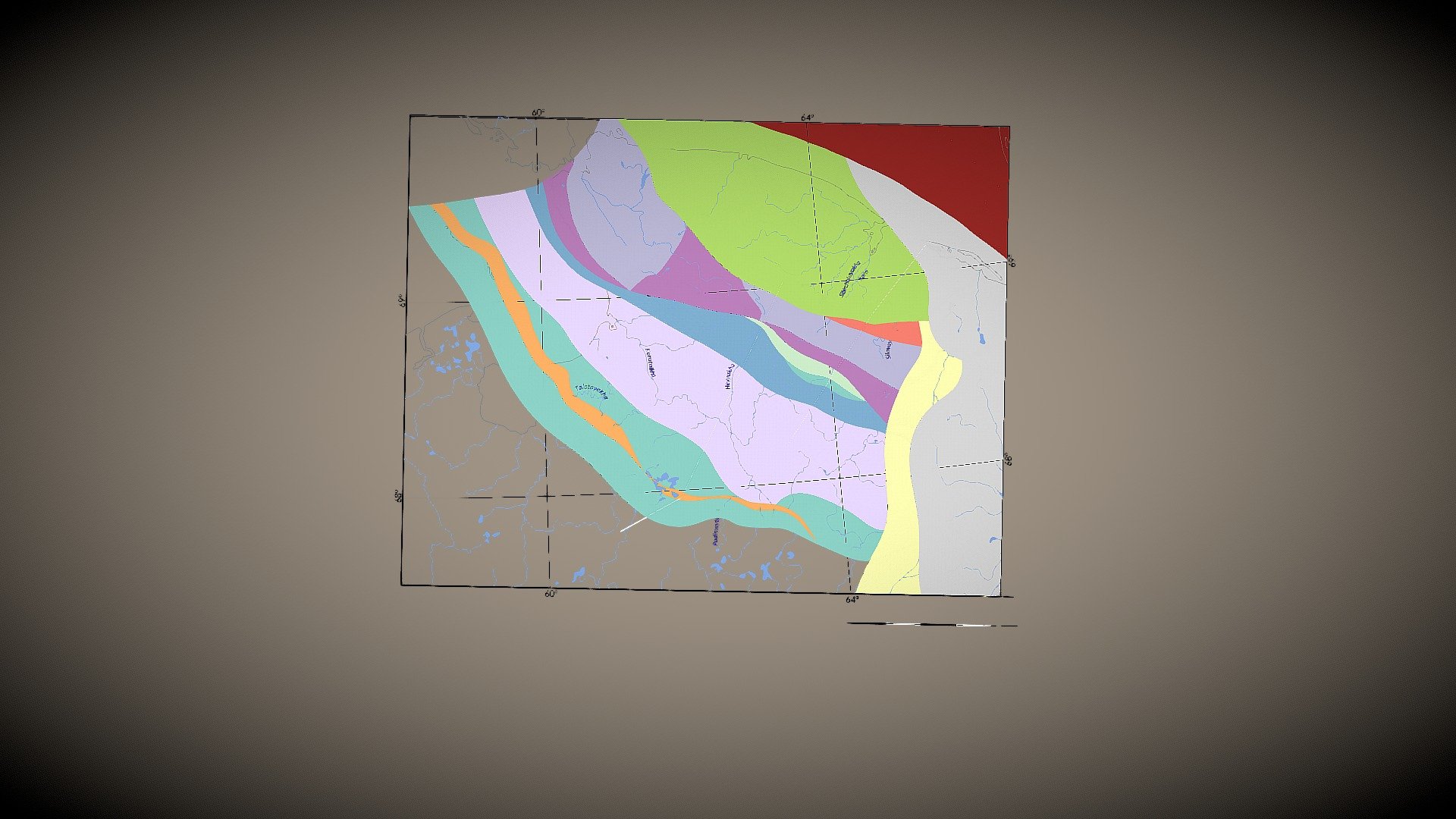
We crafted a 3D model of surfaces in southeastern areas where overthrust has occurred, specifically in Sub-Pay-Khoy – Sub-Southern Novaya Zemlya foredeep and Pay-Khoy-Novaya Zemlya folded systems based on past [2] and current [1, 3] data. The model accurately depicts the area's complex structure, including detachment surface development and fault plane relationships in three-dimensional space. The lower boundary of the model is defined by the detachment surface at the base of Korotaikha Depression's sedimentary cover. The southwestern border is marked by a Talota Thrust ramp, while the northeastern border is situated along Baydarata Suture. State Geological Map of Russia, Scale 1:1,000,000 (Third Generation), South Kara Series: R-41 (Amderma). VSEGEI. Yudin V.V. Orogeny in Northern Urals & Pay-Khoy. UIF Nauka, Ekaterinburg. 1994. Yudin V.V., Remizov D.N. A balanced geodynamic model on Polyarnouralsky transect profile. Materials XVI of the Geological congress of Komi Republic.
With this file you will be able to print Model of Overthrust of Korotaikha Depression with your 3D printer. Click on the button and save the file on your computer to work, edit or customize your design. You can also find more 3D designs for printers on Model of Overthrust of Korotaikha Depression.