Minnesota Lakes Map
thingiverse
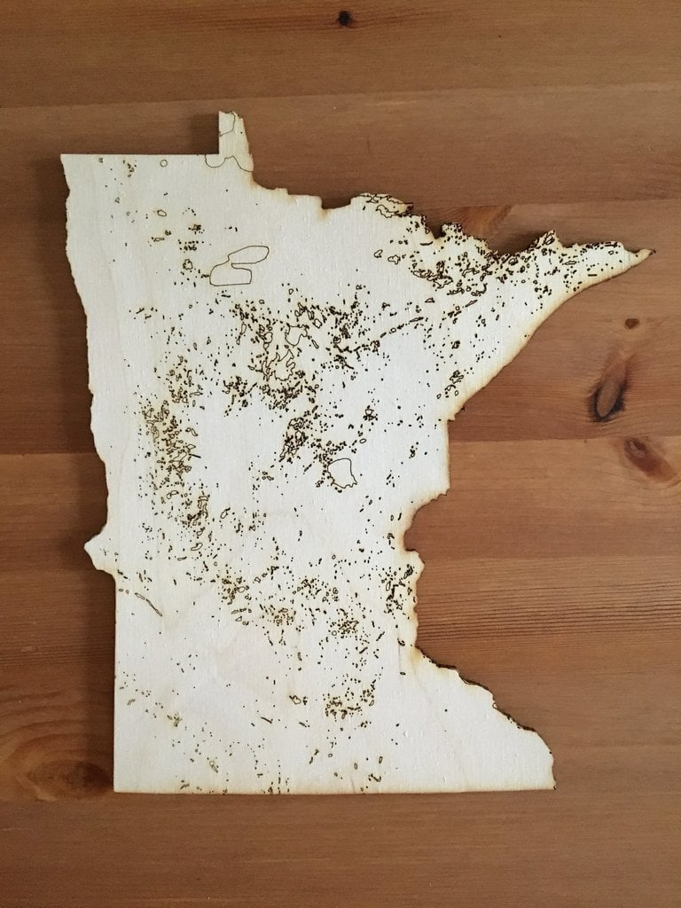
Cut on a 75W Epilog 36EXT from 1/8" Baltic Birch using precision settings for optimal results. Etched lakes are achieved at 100s/20p/500f while cuts are executed at 30s/100p/500f. Created with the latest data available from the Minnesota Geospatial Commons, this file is entirely vectors to showcase a modern look. For my printer, you can adjust line width to easily switch to raster printing if desired. Ovals at the top serve as a speed/power setting test before starting the cut process. The state border is saved in yellow with lakes in red for easy selection of either feature. I plan to cut the outline and etch the details, but you can modify these settings to suit your preferences.
With this file you will be able to print Minnesota Lakes Map with your 3D printer. Click on the button and save the file on your computer to work, edit or customize your design. You can also find more 3D designs for printers on Minnesota Lakes Map.