Medellín River (04/04/2017) (1 mission)
sketchfab
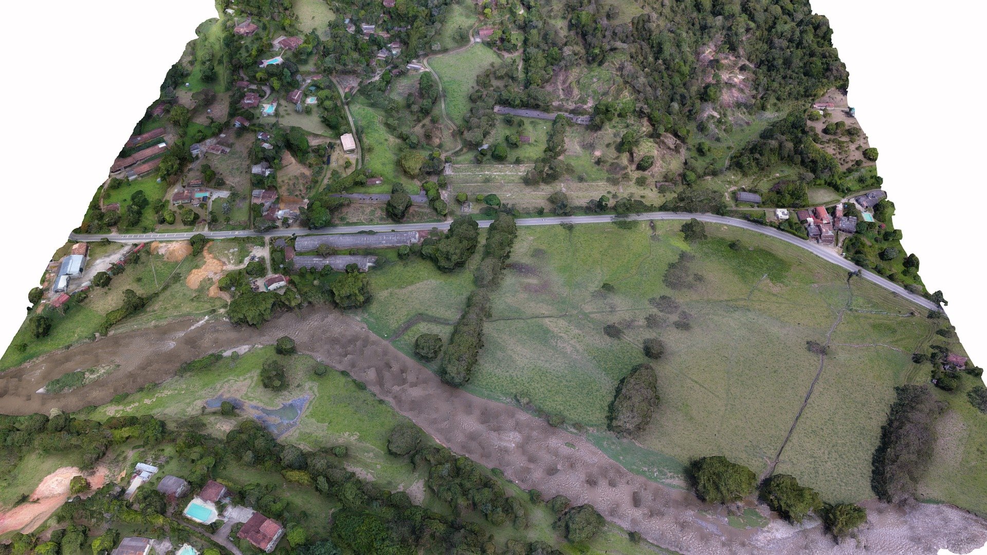
Flying Works Delivers Precise Airborne Intelligence High-resolution RGB sensor data is collected from the air over Medellín's Aburrá Valley north river. A mission was flown using a multirotor UAV system with high-resolution RGB sensors. The aircraft navigated an area of approximately 0.25 square kilometers while maintaining a stable altitude of 60 meters above ground level (AGL) and 2370 meters above mean sea level (AMSL). The flight time averaged 15 minutes in total duration.
With this file you will be able to print Medellín River (04/04/2017) (1 mission) with your 3D printer. Click on the button and save the file on your computer to work, edit or customize your design. You can also find more 3D designs for printers on Medellín River (04/04/2017) (1 mission).