Madeira, Portugal
sketchfab
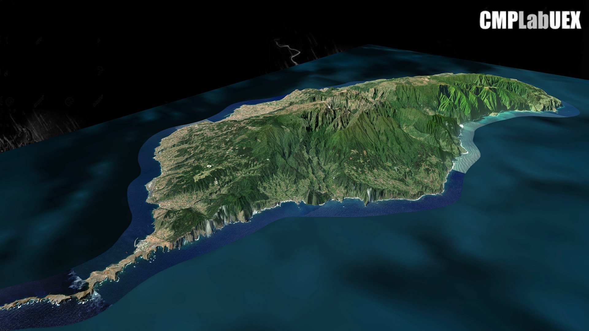
The Autonomous Region of Madeira consists of two inhabited islands, Madeira and Porto Santo, as well as three smaller uninhabited islands. It is located approximately 500 km from the Canary Islands and 860 km from Lisbon. The region's origin is volcanic in nature, with its highest point being Pico Ruivo, reaching an elevation of 1862 meters. This content was generated using QGIS and Qgis2threejs. The work is derived from the ALOS Global Digital Surface Model (AW3D30) and a Landsat image provided by the World Imagery service of ArcGIS online. For more information on how this was created, visit https://osm.org/go/bl7juMx-/?layers=C&relation=1715038. The geographical coordinates are 32.7521,-17.0583 with a zoom level of 11. To learn more about the process involved in creating this content, download the guide at https://tinyurl.com/y76md9bs
With this file you will be able to print Madeira, Portugal with your 3D printer. Click on the button and save the file on your computer to work, edit or customize your design. You can also find more 3D designs for printers on Madeira, Portugal.