Luxembourg City Low-poly 3D model
cgtrader
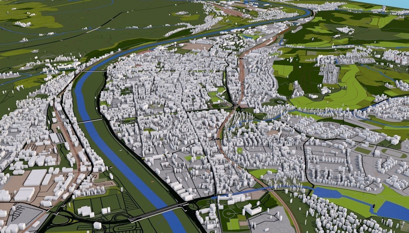
Human-generated representation of Luxembourg City utilizing 2019 mapping technology showcases roads, railways, terrain, bodies of water and buildings precisely crafted using real-world information. Every building is accurately placed, resembling the corresponding real-life structures to a remarkable degree. Notably, buildings in regions lacking complete data have been augmented with randomly generated structures, each with varying heights. Careful attention has been paid to hierarchical organization, ensuring objects are neatly grouped according to their categorization in reality. Objects possess unique and informative names along with relevant materials for a seamless visual experience. Clean UV mapping has been achieved for the majority of elements; however, cubic mapping techniques have been applied on some items to facilitate more comprehensive textures. The presented scene incorporates an assortment of object categories including (although it's possible that parts may be absent due to limitations in the original data): * Aerial ways, consisting of airways * Aerodrome structures like aprons, taxiways and terminals * Protective barriers surrounding designated boundaries * Man-made buildings ranging from detached residences to offices, hotels, farms, cabins and a vast array of residential structures including bungalows and static caravans. Also included are various industrial and commercial constructions. * Transportation pathways categorized by their complexity or level (e.g. motorways, secondary roads), foot traffic paths, cycle tracks and rail systems featuring disused funiculars and mini-rail tracks. Tourism-focused zones with abandoned, construction or miniature versions of tourist sites also feature prominently. * Geographical locations categorized as "HISTORIC," which encompass old landmarks * Divisions of the city land, separated into areas by land use (commercial, industrial or residential). * Bridge construction and natural terrain including grasslands. The city itself is identified as a Place, further divided amongst categories such as river, lake, dam or weir * Open roads that branch off from these features and can change at your leisure, courtesy of the flexible 3D scene design
With this file you will be able to print Luxembourg City Low-poly 3D model with your 3D printer. Click on the button and save the file on your computer to work, edit or customize your design. You can also find more 3D designs for printers on Luxembourg City Low-poly 3D model.