Lower 48 States in the United States
thingiverse
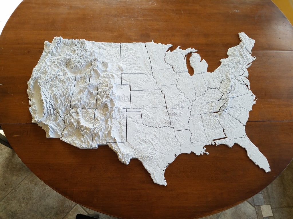
This is a model of the Lower 48 states in the US, each state boasting terrain that has been greatly exaggerated, by 50 times! Each piece fits together as a puzzle, creating a cohesive whole. Some states are grouped together due to their size (New England), while others have pieces attached to neighboring states (Michigan's Upper Peninsula is grouped with Wisconsin, yet separated by a visible border). Equal area (Albers) projection ensures relative sizes remain accurate. On a 1 to 5,000,000 scale, the model occupies roughly one meter in width when complete. If puzzle pieces aren't fitting together properly, ensure your printer doesn't suffer from an "elephant's foot" problem. We used a Lulzbot Taz 6 to prepare this model. The largest models (California, Texas) should still fit on this print bed. To alleviate the elephant's foot problem, use the "Initial Layer Horizontal Expansion" setting in Cura (set to -1). Map design by Thomas Pingel and Earle Isibue.
With this file you will be able to print Lower 48 States in the United States with your 3D printer. Click on the button and save the file on your computer to work, edit or customize your design. You can also find more 3D designs for printers on Lower 48 States in the United States.