Liguiqui near-infrared orthomosaic
sketchfab
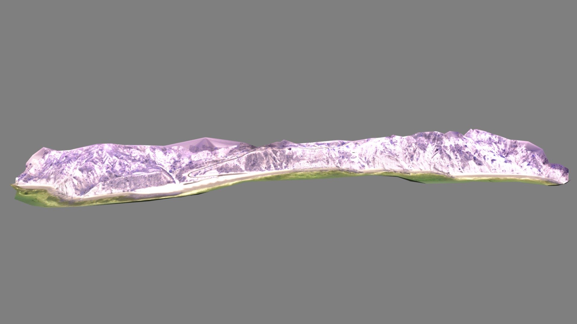
Humans observe an orthomosaic image of the Liguiqui archaeological site in Ecuador, captured in near-infrared light. The photograph reveals the coastal zone along a vast area connected to the Pre-Hispanic Manteño culture. At the center of the model lies Liguiqui beach with Punta Cangrejo situated to the north. The default view faces east towards the Manabí coastline. Visible features include submerged stone fishing traps, also known as weirs, in the intertidal zone indicating intense fishing activity. A 2015 survey conducted by Universidad Técnica de Manabí and Auburn University at Montgomery faculty and students captured this image using a senseFly ebee Ag equipped with a Canon S110 NIR camera. The data was then processed using Agisoft Metashape Professional software.
With this file you will be able to print Liguiqui near-infrared orthomosaic with your 3D printer. Click on the button and save the file on your computer to work, edit or customize your design. You can also find more 3D designs for printers on Liguiqui near-infrared orthomosaic.