Lhotse
sketchfab
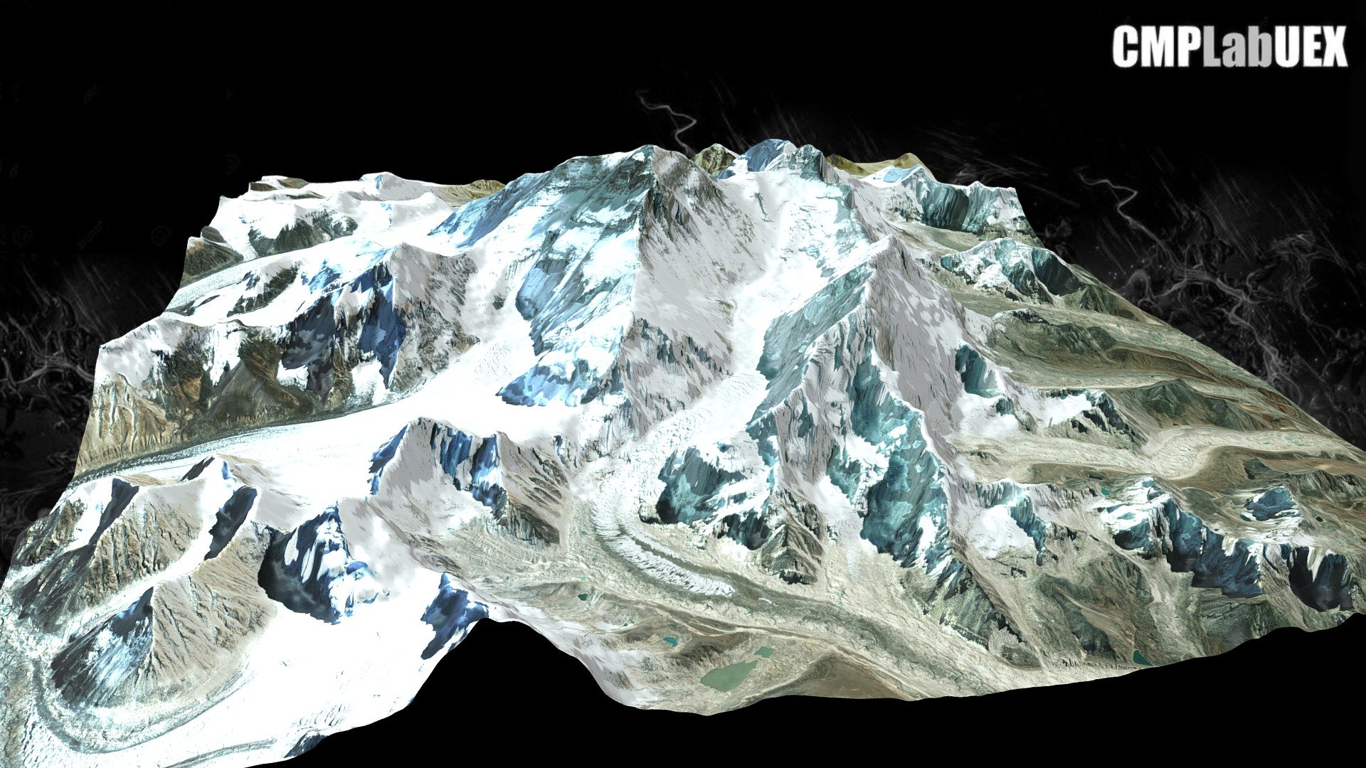
The Lhotse mountain stands at 8383 meters high, ranking it as the fourth highest mountain on Earth, surpassed only by Everest, K2 and Kangchenjunga. It is connected to Everest via the South Col. Situated on the border between southern Tibet's region and Khumbu region in northern Nepal. This image was created using QGIS and Qgis2threejs software. The base map was derived from ALOS Global Digital Surface Model (AW3D30) data, combined with a Landsat image from the World Imagery service of ArcGIS online. For more information on how to create similar maps, visit https://tinyurl.com/y76md9bs
With this file you will be able to print Lhotse with your 3D printer. Click on the button and save the file on your computer to work, edit or customize your design. You can also find more 3D designs for printers on Lhotse.