Larus Park Trails
sketchfab
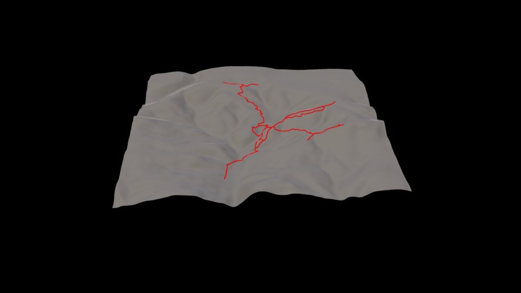
This is a visual representation of the trails within Larus Park in Richmond, Virginia, USA, condensed to focus on the landscape's features and trail placement. The depicted area spans approximately one square mile, with elevations varying from 119 to 351 feet, amplified by a 4X vertical exaggeration for clarity. The terrain was meticulously mapped by James River Park System enthusiast JB at 1.7 meter intervals, with data interpolated along a cubic spline at 1 meter increments and then matched to a 10mX10m DEM using ArcGIS 10.2 software. Visualizations were created in Cinema4D R16 utilizing the Sweep NURBS tool on a relief surface, and the final output was uploaded to Sketchfab.com via the exporter developed by 990adjustments. This digital map is not intended as an authoritative or precise portrayal of Larus Park's trails; rather, it serves as a tribute to the intricate landscapes of the Piedmont region and the trails that allow explorers to discover its subtleties.
With this file you will be able to print Larus Park Trails with your 3D printer. Click on the button and save the file on your computer to work, edit or customize your design. You can also find more 3D designs for printers on Larus Park Trails.