Ladera mina Utrillas
sketchfab
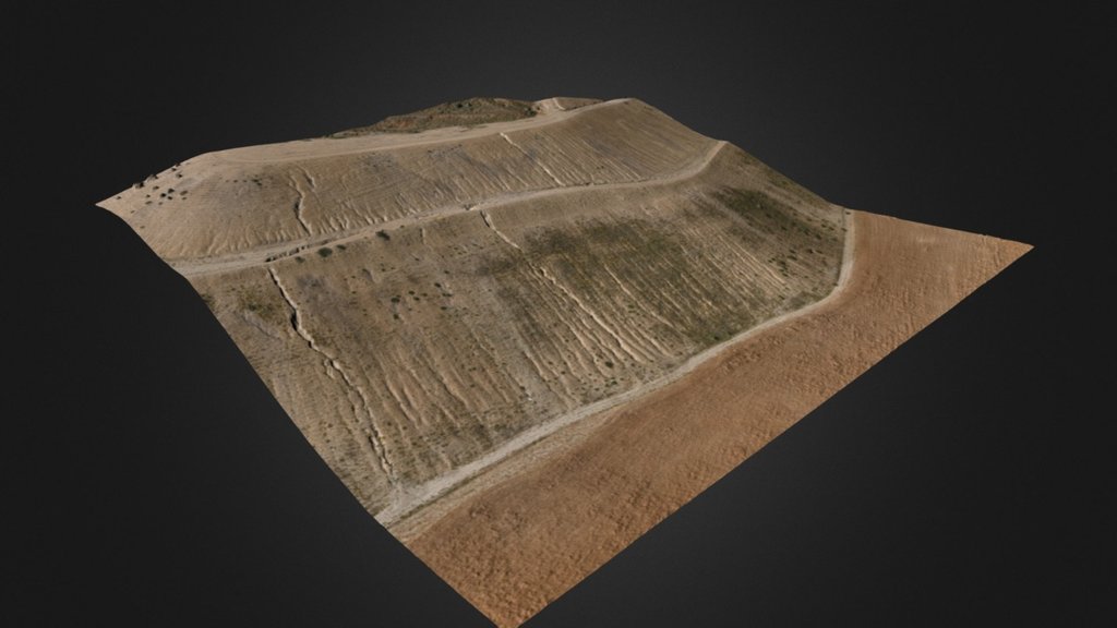
High-accuracy modeling based on aerial photogrammetry of the slopes of an old mining operation with first-generation restoration in Utrillas, Teruel. The goal is to understand its evolution from georeferenced orthophotos at different stages. Coordinate system: UTM ETRS89 Zone 30N Ground sampling distance (GSD): 0.025m Accuracy in support points: 0.02m Equipment used: Hexacopter DJI S900 with Lumix GH4 Datalink and Ground Station GPS Leica GS15 VIVA GNSS (Aragea) Precision aerial solutions Registered in AESA No.8052/RG8267 www.aereal.pro/engineering ingenieria@aereal.pro +34 628 069 536
With this file you will be able to print Ladera mina Utrillas with your 3D printer. Click on the button and save the file on your computer to work, edit or customize your design. You can also find more 3D designs for printers on Ladera mina Utrillas.