Kapp Linné 1936-1990-2008 Difference
sketchfab
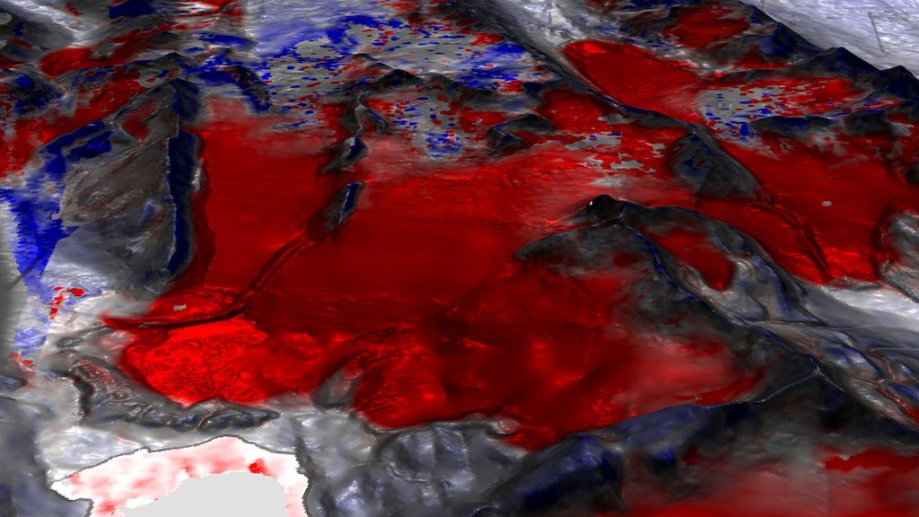
Preliminary M3C2 findings reveal stark contrasts when comparing the SfM-MVS model from 1936 against raster DEM's from 1990 and 2008 courtesy of Norsk Polarinstitutt. A vibrant color palette signifies surface change, meticulously measured perpendicular to the terrain between models. Distances are carefully projected onto the 1990 or 2008 surface. Experience the environment as it stood in 1936 Gray hues signify areas lacking data The 1936 model was constructed from an impressive 85 aerial oblique images captured by Norsk Polarinstitutt, complemented by 97 GCP's derived from modern sources. These findings are preliminary and may contain errors. Version 1.5 (August 1, 2017)
With this file you will be able to print Kapp Linné 1936-1990-2008 Difference with your 3D printer. Click on the button and save the file on your computer to work, edit or customize your design. You can also find more 3D designs for printers on Kapp Linné 1936-1990-2008 Difference.