Just north of Hawes on River Ure floodplain
sketchfab
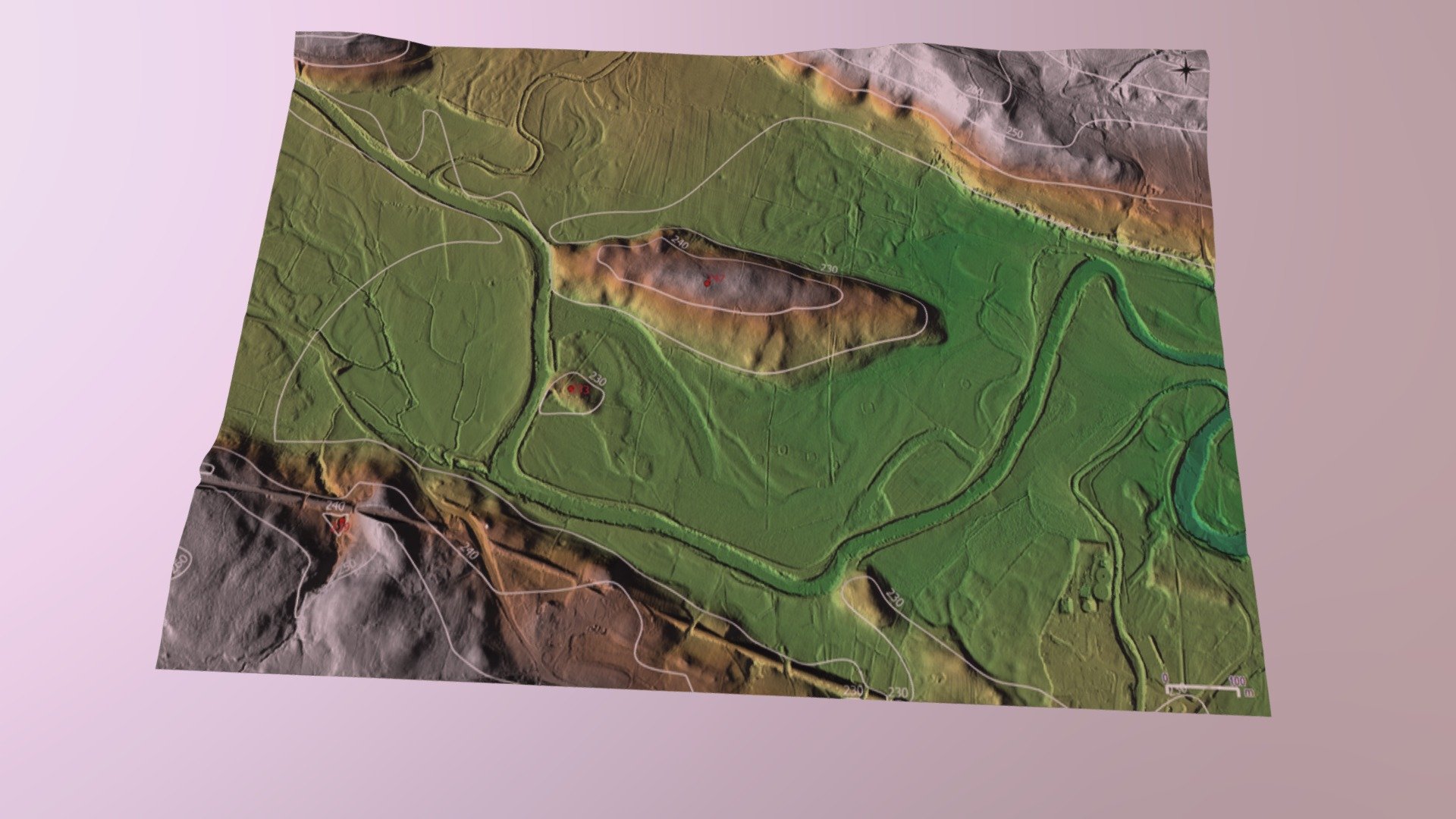
The River Ure's floodplain is teeming with intriguing earthworks, all perfectly visible on the opposite side of Hawes. A 3D model has been expertly crafted from a 50cm DTM LIDAR dataset using QGIS and carefully selected color-ramps to precisely code elevations. To fully appreciate these features, zoom in and pan around the model - you'll find helpful navigation tips by clicking on the ? icon located conveniently at the bottom right of the screen.
Download Model from sketchfab
With this file you will be able to print Just north of Hawes on River Ure floodplain with your 3D printer. Click on the button and save the file on your computer to work, edit or customize your design. You can also find more 3D designs for printers on Just north of Hawes on River Ure floodplain.