Historical Center of Bethlehem - UAV survey
sketchfab
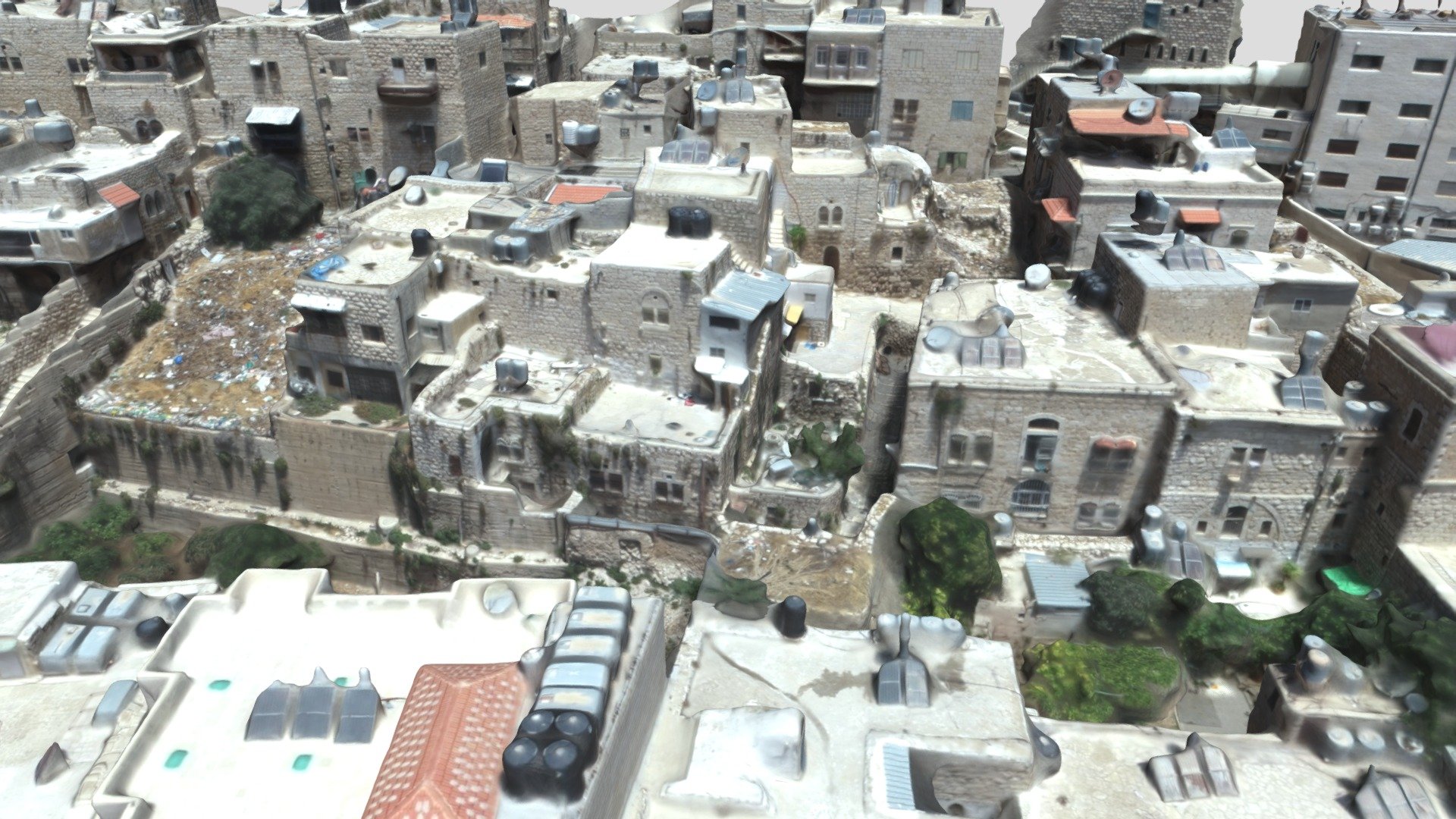
In its modern form, the Old City is made up of districts that have developed haphazardly in a concentric pattern around Manger Square, including areas such as al-Najajreh, al-Farahieh, al-Anatreh, al-Tarajmeh, al-Qawawseh, al-Hreizat and al-Fawagreh. The architectural legacy within the ancient city, defined by the presence of various cultures and urban planning policies, reveals a complex layering of systems and building units, also evident in the use of materials and the reuse of technological and decorative elements, which highlight the transformations of buildings and the history of settlements. The drone documentation has been used to capture roofs and the upper sections of facades, taking advantage of the natural slope of the hillside that forms the historical center. The integration of metric data between the two systems was achieved using laser scanner stations on top of strategically selected buildings, chosen for their position and height, which provided reference points for georeferencing aerial data.
With this file you will be able to print Historical Center of Bethlehem - UAV survey with your 3D printer. Click on the button and save the file on your computer to work, edit or customize your design. You can also find more 3D designs for printers on Historical Center of Bethlehem - UAV survey.