Historic Saltmine Sinkhole Collapse 2016 Survey
sketchfab
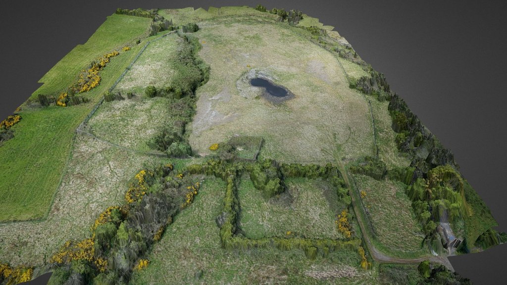
3D Modelers Capture Sinkhole Collapse in Northern Ireland Mine Using Drone Imagery and GPS Data. The model depicts the sinkhole's current state after remediation work was completed, revealing its topography. The 3D representation is based on aerial surveys conducted using drones and GPS ground control points. This project was funded by NERC as part of research into InSAR for geotechnical infrastructure, allowing stakeholders to assess environmental risks remotely with the help of the GIS Research Unit at Queens University Belfast's School of Geography, Archaeology, and Palaeoecology.
With this file you will be able to print Historic Saltmine Sinkhole Collapse 2016 Survey with your 3D printer. Click on the button and save the file on your computer to work, edit or customize your design. You can also find more 3D designs for printers on Historic Saltmine Sinkhole Collapse 2016 Survey.