Hagg Farm 2018 Season Elevation LiDAR DSM model
sketchfab
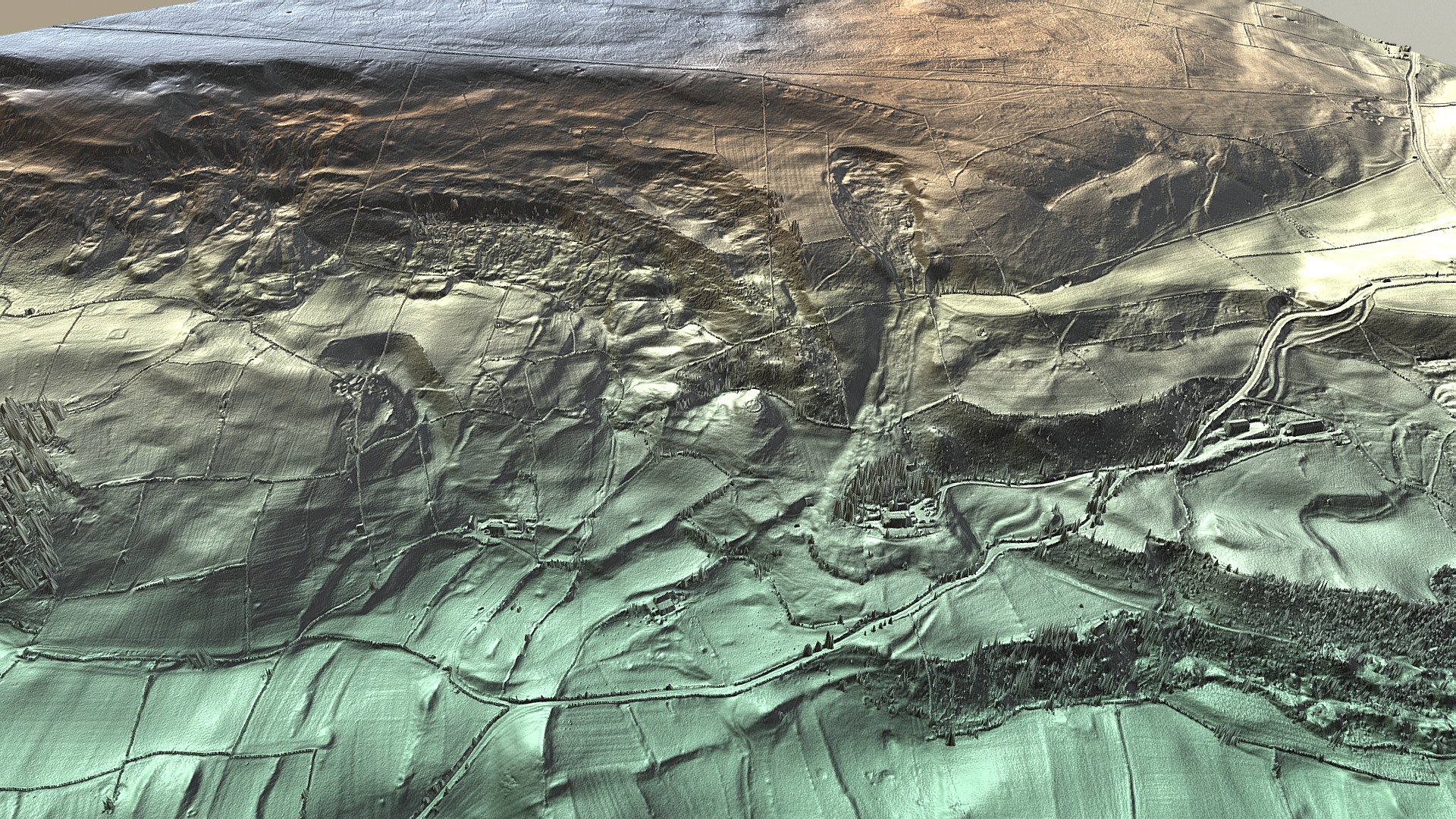
Hagg Farm multi-period landscape in Swaledale near Fremington, Reeth, North Yorkshire boasts a rich history that can be explored through the reports menu at https://www.swaag.org/LEADER/reports.htm. The LiDAR Elevation model utilizing 50cm DSM provides a precise topographical representation of the area. The software used to create this model is showcased at https://www.planlauf.com/en/planlaufterrain/download-purchase/.
Download Model from sketchfab
With this file you will be able to print Hagg Farm 2018 Season Elevation LiDAR DSM model with your 3D printer. Click on the button and save the file on your computer to work, edit or customize your design. You can also find more 3D designs for printers on Hagg Farm 2018 Season Elevation LiDAR DSM model.