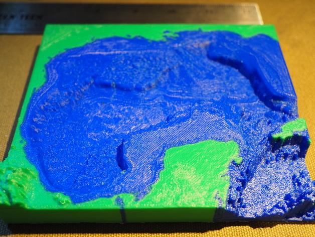
Gulf of Mexico - Dual Color
thingiverse
Topography and Bathymetry of the Gulf of Mexico Explored in 3D Detail A detailed three-dimensional model of the Gulf of Mexico's topography and bathymetry, viewed at an impressive vertical exaggeration of three times the actual size. Two separate STL files contain the data above sea level and below it. The data is derived from a highly advanced STRM30_Plus topographic and bathymetric database, available online at http://topex.ucsd.edu/WWW_html/srtm30_plus.html. The original source for this valuable information can be accessed here: however, the link seems to be temporarily unavailable due to server issues, found on this site: http://gcoos.tamu.edu/products/topography/Introduction.html. I have made an informed decision to color-coordinate the top and bottom sections of the model, allowing users to see a consistent coloring throughout. Instead of adding an extra layer of sea level data as a separate component. Printable Instructions The three-dimensional print model is created using a raft base support, with two outer shells, and filled with a 15% dense structure that serves several purposes - including improving structural strength, while also providing enough foundational support for the model's flat areas. To visualize this remarkable model in its actual printed form, view pictures taken of it printed on a FlashForge Creator Pro using Hatchbox ABS filament, which has a color-changing quality between blue and green tones with each layer printing at 0.2 mm resolution. Another amazing aspect is the captivating visual representation created by simply printing the bathymetry portion of the data, showcasing stunning results!
With this file you will be able to print Gulf of Mexico - Dual Color with your 3D printer. Click on the button and save the file on your computer to work, edit or customize your design. You can also find more 3D designs for printers on Gulf of Mexico - Dual Color.
