Great Britain & Ireland Map
prusaprinters
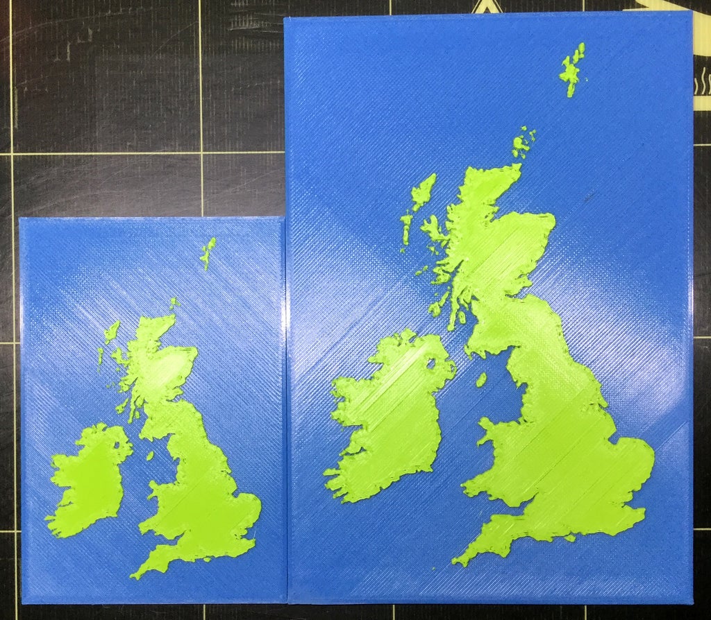
<p>A detailed map of Great Britain & Ireland rendered in two colours. Along with the .stl, two versions of the PrusaControl generated .gcode are included, one at 100% (0.15 Resolution) and the other at 150% (0.2 Resolution)</p> <h3>Print instructions</h3><p>Unassociated tags: Great Britain, Great Britain Map, Grt Britain & Ireland, United Kingdom, United Kingdom Map</p> <h3>Category: Buildings & Structures Summary</h3> <p>A detailed map of Great Britain & Ireland rendered in two colours. Along with the .stl, two versions of the PrusaControl generated .gcode are included, one at 100% (0.15 Resolution) and the other at 150% (0.2 Resolution)</p> <h3> Print Settings</h3> <p><strong>Printer Brand:</strong> Prusa</p> <p><strong>Printer:</strong> Prusa Mk2</p> <p><strong>Rafts:</strong> No</p> <p><strong>Supports:</strong> No</p> <p><strong>Resolution:</strong> 0.2 & 0.15</p> <p><strong>Infill:</strong> 20%</p>
With this file you will be able to print Great Britain & Ireland Map with your 3D printer. Click on the button and save the file on your computer to work, edit or customize your design. You can also find more 3D designs for printers on Great Britain & Ireland Map.