Grand Canyon v3
sketchfab
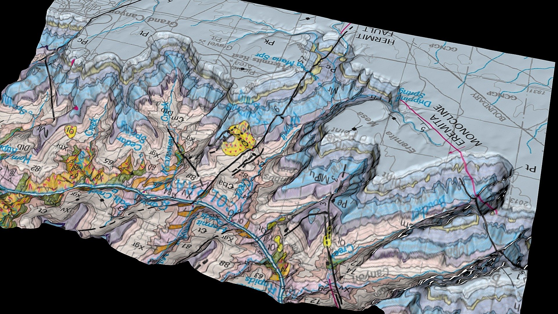
Overlaying a georeferenced geologic map directly onto DEM topography allows researchers to seamlessly merge geological data with precise three-dimensional terrain information, creating an integrated and highly detailed visual representation of the landscape. This powerful tool empowers scientists to analyze complex relationships between geology and topography with unprecedented clarity and accuracy. By combining these two vital datasets, researchers can gain a deeper understanding of how geological formations influence local topography, leading to groundbreaking discoveries and insights into the Earth's intricate systems.
With this file you will be able to print Grand Canyon v3 with your 3D printer. Click on the button and save the file on your computer to work, edit or customize your design. You can also find more 3D designs for printers on Grand Canyon v3.