Grand Canyon South Corridor 3d topo
thingiverse
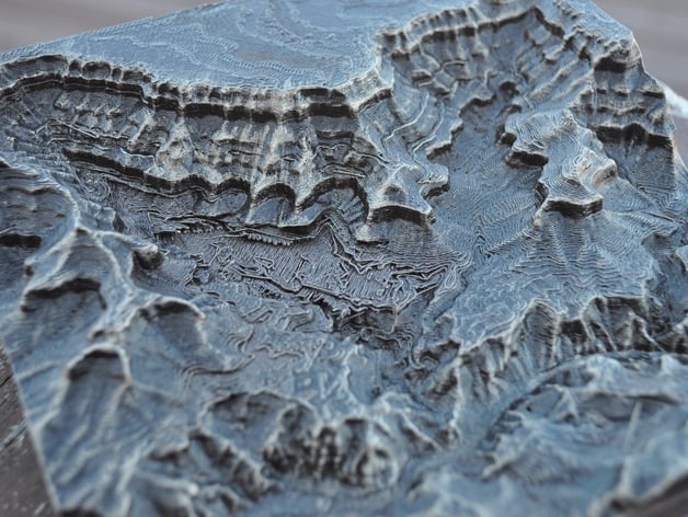
Here's a detailed 3D topographic map of the Grand Canyon's South Corridor, focusing on the Village area and surrounding paths like the Phantom Ranch. The Village section also features sections along South Kaibab Trail along with the trails connected directly to it; including the entire path leading to the trail known as Bright Angel Trail. Printed with prototype PLA filament using Printerbot Metal Simple machine from a quality 3D printing supply company. It had a distinctive finish in an oil-rubbed bronze colour acquired by spray painting and then adding further effect through use of silver Guilder's Paste in order dry brush the details making it more detailed visually. Listen to what was discussed regarding how best achieve great 3D printing quality, particularly this finish style used here and even on making a map in three dimensions from satellite image or even other form of map in this post for 3d printed maps. All this info also available for everyone who likes 3d maps or similar topics that would surely like. Visit http://threedprintingtoday.libsyn.com/ in your browser, look it up on Apple's own store "iTunes", download or install a media player called Stitcher - one with huge amount podcasts about technology including audio interviews as guest on these show where they discussed about how we should build three dimension printing models from actual terrain mapping sources using topographical information data for that map so to get more detailed information in detail by viewing https://www.youtube.com/watch?v=bzwybr65I9o and see it now
With this file you will be able to print Grand Canyon South Corridor 3d topo with your 3D printer. Click on the button and save the file on your computer to work, edit or customize your design. You can also find more 3D designs for printers on Grand Canyon South Corridor 3d topo.