GGI LiDAR Transmission Powerline Vegetation _1
sketchfab
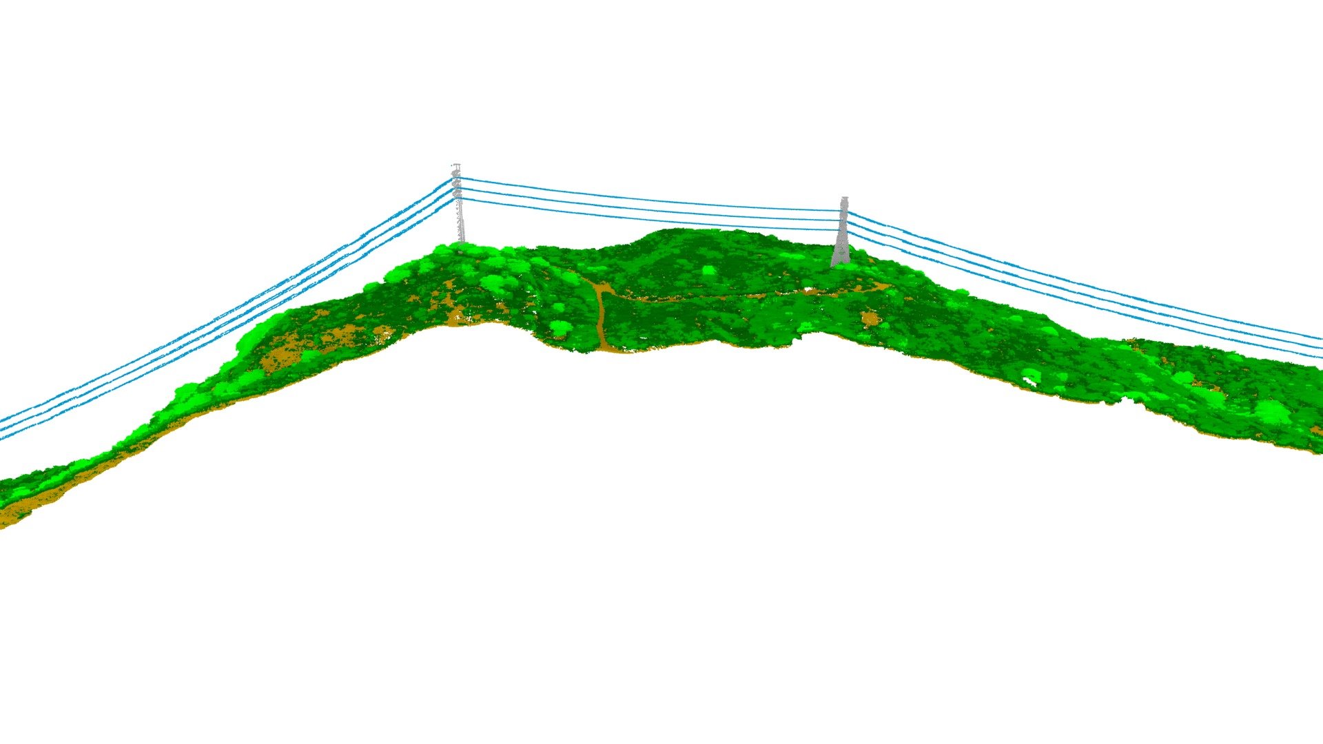
In February 2021, we gathered approximately 20 square miles of terrain containing transmission and distribution power lines simultaneously to validate the latest airborne LiDAR sensor from a fixed wing aircraft using wide-area collection mode. This method is the most efficient, effective, and accurate way to collect LiDAR data for power lines and vegetation. The LiDAR point cloud model shown here is a section of a transmission circuit right-of-way (approximately 3500 ft long x 500 ft wide) in rugged high fire threat terrain. This model provides an extremely high-quality input for our proprietary powerline asset and vegetation management analytics. We can calculate vegetation encroachment and powerline clearance with centimeter-level accuracy. In this section, no hazards were identified. This is a fantastic periodic inspection tool to verify that the vegetation has been maintained and immediate actions are not required. We have the capability to collect and process hundreds of miles of data every few weeks.
With this file you will be able to print GGI LiDAR Transmission Powerline Vegetation _1 with your 3D printer. Click on the button and save the file on your computer to work, edit or customize your design. You can also find more 3D designs for printers on GGI LiDAR Transmission Powerline Vegetation _1.