Folded unconformity at Kamsdorf quarry
sketchfab
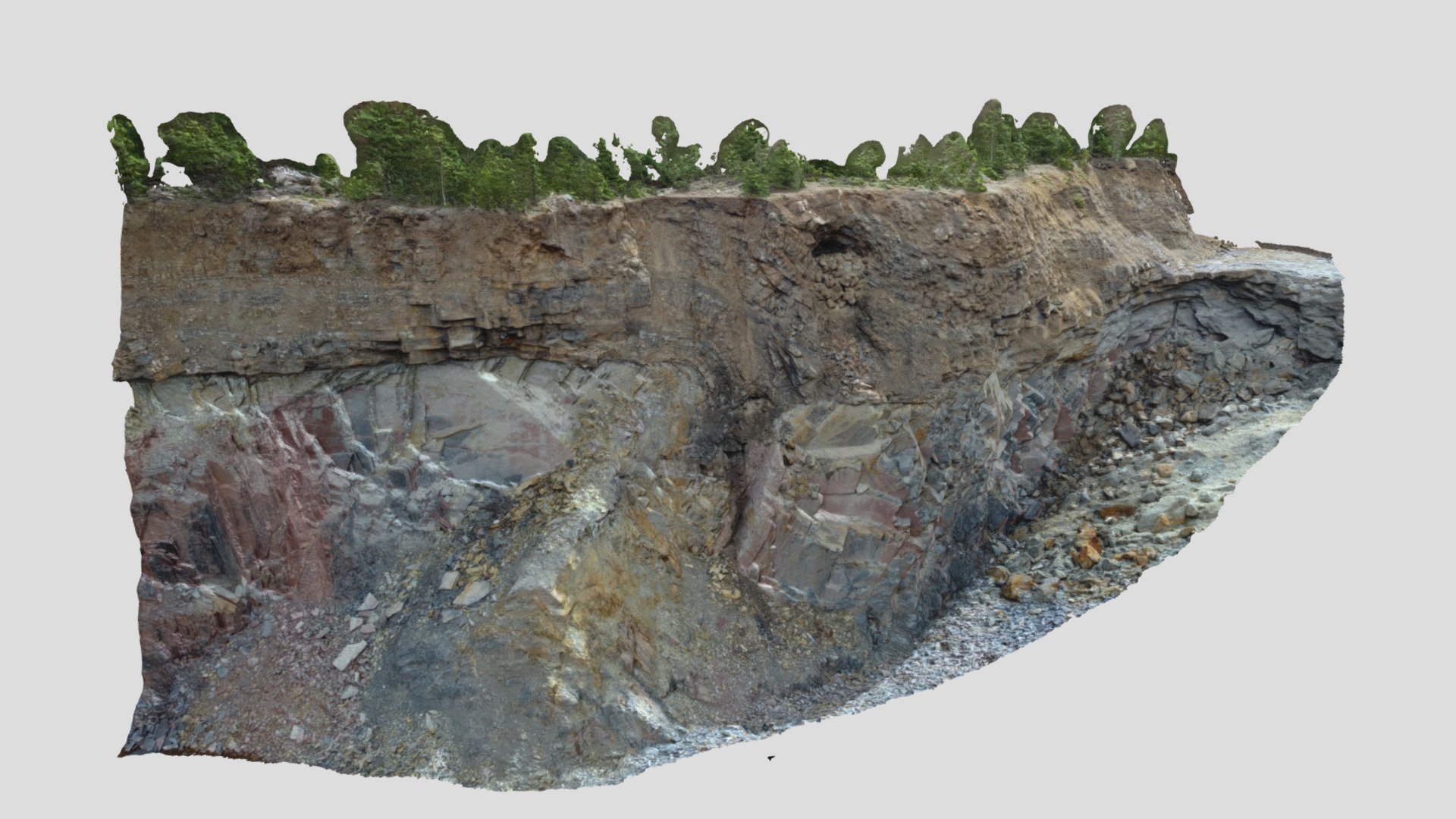
Drone-based photogrammetric model of the eastern wall of a large quarry at Kamsdorf in Thuringia, Germany, using imagery acquired by @chgruetze on 05 July 2020. Outcrop coordinates are 50°38‘36.0”N 11°29‘09.8”E. The model was created by @GeoBenni using Agisoft Metashape Pro. The outcrop exposes a folded angular unconformity at the base of the Late Permian Zechstein succession, consisting of dark, bituminous dolomitic limestones overlying Early Carboniferous slates. Folded Zechstein deposits form the tip of a south-vergent fault propagation fold with a N-dipping reverse fault cutting through the slates. A previous N-dipping normal fault just a few meters to the south adds an extra layer of complexity to the structure.
With this file you will be able to print Folded unconformity at Kamsdorf quarry with your 3D printer. Click on the button and save the file on your computer to work, edit or customize your design. You can also find more 3D designs for printers on Folded unconformity at Kamsdorf quarry.