Epsom campus
sketchfab
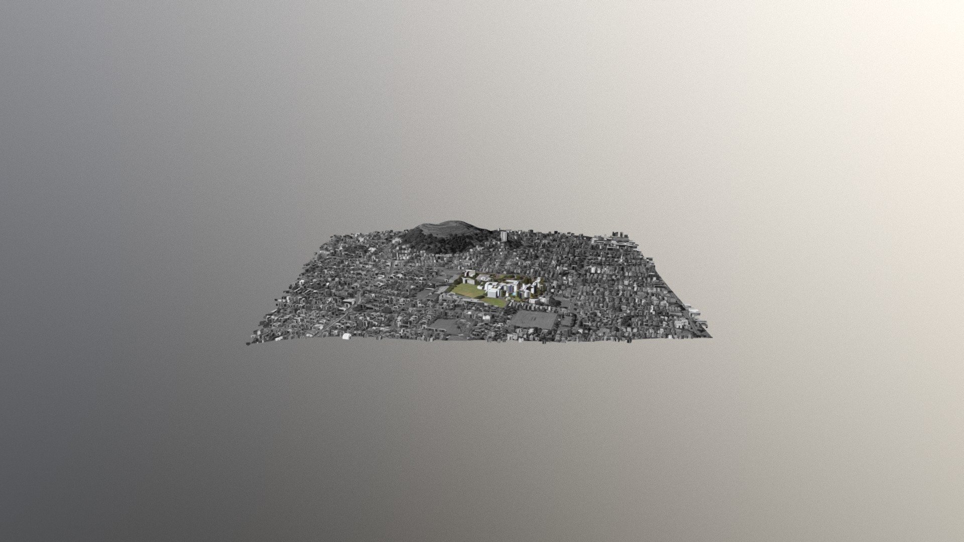
Aerial photographs of Auckland's urban areas, captured in 2015 and 2016, are available at the LINZ Data Service. These images provide a detailed view of the city's landscape, including buildings, roads, and natural features. To create these photographs, high-resolution cameras were mounted on aircraft that flew over the area, taking hundreds of photos from different angles. The resulting images are stitched together to form a seamless mosaic, offering a bird's-eye view of the city. The photographs can be used for various purposes, such as urban planning, environmental monitoring, and hazard management. In addition to these aerial photographs, the LINZ Data Service also offers a DEM (Digital Elevation Model) dataset for Auckland, which provides detailed information about the city's topography. This data was captured in 2013 using lidar technology, which uses laser pulses to measure the height of objects on the ground. The resulting DEM is a 1-meter resolution grid that shows the elevation of every point within the study area.
With this file you will be able to print Epsom campus with your 3D printer. Click on the button and save the file on your computer to work, edit or customize your design. You can also find more 3D designs for printers on Epsom campus.