El Hierro, Islas Canarias, España
sketchfab
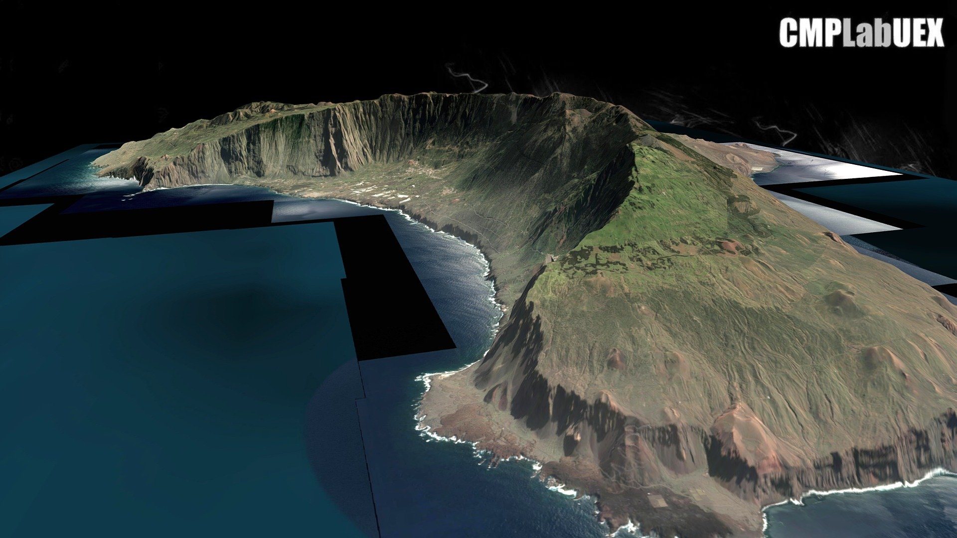
The Westernmost island of the Canary Islands is El Hierro, located in the Atlantic Ocean. It belongs to the province of Santa Cruz de Tenerife. This model was generated using QGIS and Qgis2threejs. The work is derived from ALOS Global Digital Surface Model (AW3D30) and an image from Landsat via the World Imagery service on ArcGIS online. You can find this location at https://osm.org/go/bh8dOyn–?layers=C geo:27.7436,-18.0648?z=12 To learn how it's done, download a guide at https://tinyurl.com/y76md9bs
With this file you will be able to print El Hierro, Islas Canarias, España with your 3D printer. Click on the button and save the file on your computer to work, edit or customize your design. You can also find more 3D designs for printers on El Hierro, Islas Canarias, España.